Tasmania, Australia. The Apple Isle, as it used to be known. It has also been called ‘ the island that’s Australia’s bejewelled earring.’ Haven’t heard that one before!
Update 2022. Perhaps due to a change of government, Tassie has picked up economically, and the population is now at about 540 000, which is a significant increase over the last few years.
Tassie’s natural beauty is undeniable, and in these pics, mainly from Fred Vanderbom, we can see some of it. Thanks, Fred, for the privilege of using your pics.
Fred grew up in Tasmania and lived there for years. Although he now lives in South Australia, he still loves Tassie! He is also pretty handy with a camera.

Copyright © Fred Vanderbom
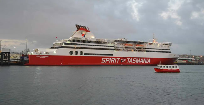
The Spirit of Tasmania is one of the main ways of getting there, especially if you want to bring your car.
Pictured here in Devonport on the northwest coast of Tasmania, the Spirit of Tasmania sails from Geelong. Formerly it sailed from Station Pier in Melbourne. It takes about 14 hours to complete the trip to Devonport. There are actually two identical Spirit of Tasmania ships, both built in Finland. They cover the same route but in opposite directions, passing each other in the night. That enables a daily service to operate consistently.
There are two new Spirit of Tasmania ships currently being built in Finland. There is a bit of a problem – the ships’ draft is too deep, so Devenport Harbour will have to be dredged before they can be used!
There was actually a third Spirit of Tasmania for a while, operating out of Sydney, but patronage wasn’t enough to make it economically viable.
Copyright © Fred Vanderbom
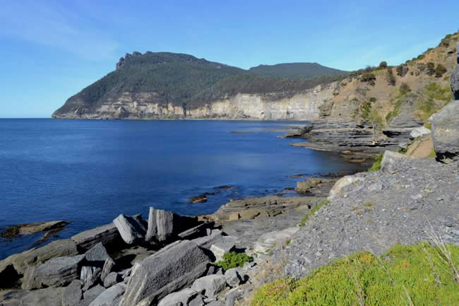
The “Bishop and Clerk” peak at the northern end overlooks spectacular cliffs which contain so many fossils that this area was mined for some years in the 1920s for a cement industry on the island.
These mountains look a bit like a bishop with his mitre followed by his clerk, hence the name.
Maria Island was named by that tenacious and capable Dutch seaman Abel Tasman, after whom Tasmania is named, in honour of the wife of the then Governor-General of the Dutch East Indies in Batavia.
After being used by sealers, whalers and smugglers for a while, a convict settlement was established on Maria Island in 1825. By 1884 it was closed and the island leased to an Italian businessman Diego Bernacchi, who established vineyards and the Grand Hotel, and later also a cement works. These ventures all eventually failed, and the island became a haven for holidaymakers, which it still is today. It was declared a wildlife reserve in 1971 and a National Park in 1972.
More info on Maria Island can be found at Australian Geographic and Wikipedia
Copyright © Fred Vanderbom
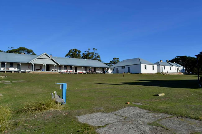
Maria Island: the barracks of the convict era have survived and are used as accommodation for campers and school groups.
Maria Island was originally inhabited by part of the Oyster Bay Aboriginal tribe. There were two periods of convict presence on the island: between 1825 and 1832, and later on as a probation station between 1842 and 1851. These are the barracks, built by the convicts for convicts.
Copyright © Fred Vanderbom
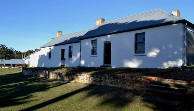
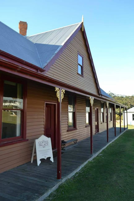
Smith O’Brien was an Irish nationalist who was “transported” to suit Ireland’s British overlords in the early 19th century. He lived in this cottage for some time and also at the better-known Port Arthur address. Eventually he was allowed to return home and continued to support Irish independence.
Smith O’Brien was exiled for his part in the Young Irelander Rebellion of 1848. After Maria Island he lived at the Port Arthur penal colony for a time before being transferred to New Norfolk north of Hobart.
Copyright © Fred Vanderbom
The Grand Hotel was built late in the 19th century to accommodate visitors to the vineyards and later cement industry on the island. I (Fred) stayed here too during several week-long adventure school camps in the 1960s.
This was part of Italian businessman Diego Bernacchi’s dream for this island. I reckon he was a visionary, before his time. If he had established vineyards and a hotel in the early 21st century he would have established a first rate resort in a truly beautiful spot.
Copyright © Fred Vanderbom
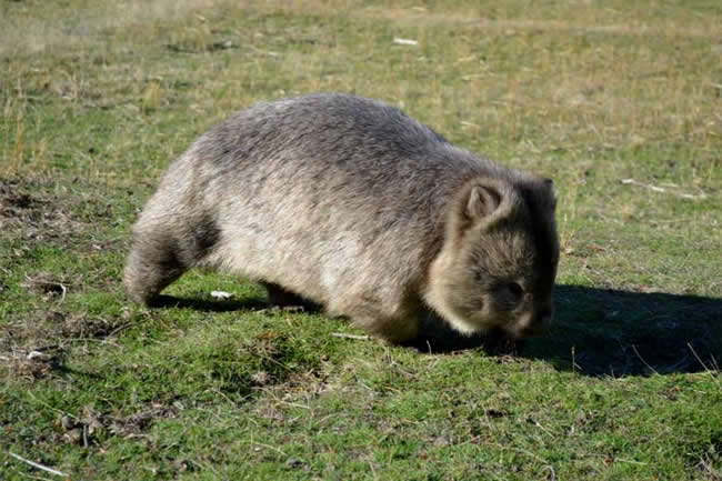
Today Maria Island is a wildlife sanctuary for native birds, mammals including lots of wombats, and a colony of Tassie Devils which we found very reclusive; they are threatened by an infectious cancer.
Copyright © Fred Vanderbom
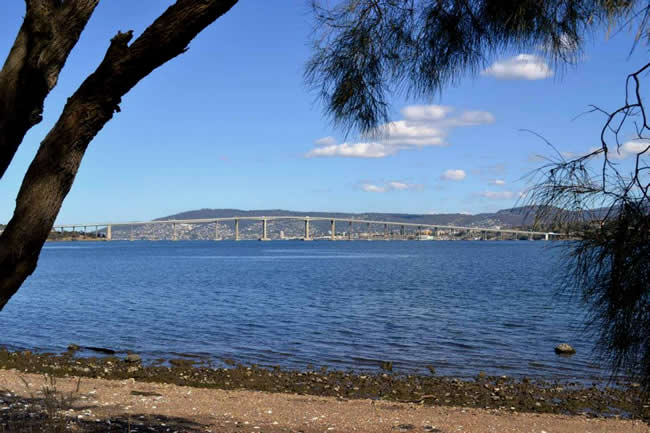
Hobart’s River Derwent is full of history and memories, including the Tasman Bridge.
On 5 January 1975, the bulk ore carrier Lake Illawarra, carrying 10 000 tonnes of zinc upstream to the Electrolytic Zinc works, hit the pylons of the bridge causing three of its spans to collapse. The roadway landed on the ship causing it to sink within minutes. Seven crew members were drowned because they were below decks at the time.
Five people in four cars that drove off the bridge were also killed as a result of the 45 metre fall into the river. Several other cars just barely stopped in time and ended up with their front wheels dangling over the side.
The loss of the bridge link between the eastern and western sides of Hobart caused some significant social problems. The bridge was re-opened on 8 October 1977, some twenty one months after the collapse. There is a very useful article on the bridge collapse and it’s effects on the local community in Wikipedia.
Copyright © Fred Vanderbom
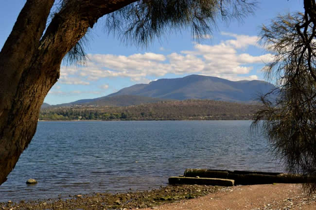
Hobart’s Mt Wellington dominates the landscape, and the city’s Domain makes this photo look as if the State’s capital is all bush.
________________________________
How to use self adhesive labels? Click here for self adhesive paper labels info: Labels Information Page – Everylabels.com.au
________________________________
Copyright © Fred Vanderbom
Hema HX-2+ Navigator – This is Australia! Brilliant both on road and off road!
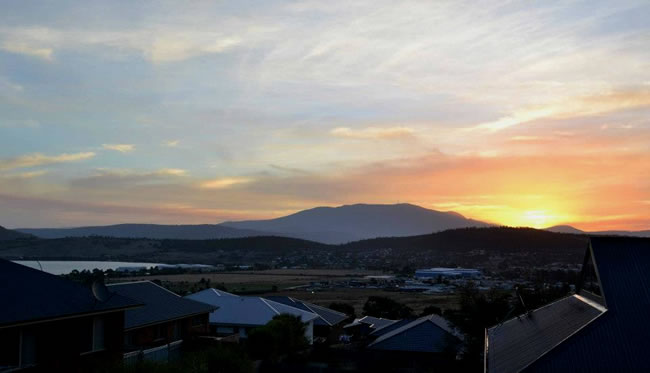
Sunset view to Mt Wellington over the suburb and one of the River Derwent’s bays.
Copyright © Fred Vanderbom
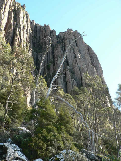
Hobart’s Mt Wellington (1270m) close-up: its most familiar feature is “the Organ Pipes”, the dolerite columns so typical of Tassie’s mountains and coastline.
Copyright © Fred Vanderbom
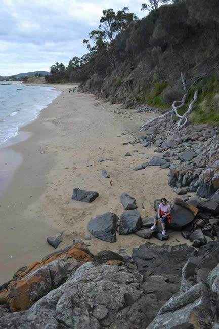
Roches Beach is a beachside suburb about 14 kilometres from the city centre, on the eastern shore of the river. At the 2011 census it had a population of 214. The beach is a great place to walk.
Copyright © Fred Vanderbom
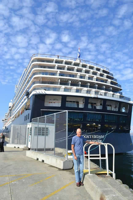
Appropriately flying the Netherlands flag (Abel Tasman was, after all, a Dutchman) the Oosterdam in port at Hobart. The Oosterdam was nearing the end of a 2 week round-trip of the Tasman Sea.
Tourism is a major industry in Tasmania, although it hasn’t been able to arrest Tasmania’s economic decline.
Although the Oosterdam is a very big ship at 290 metres length, and with a tonnage of 82 000 tons, she isn’t even close to the biggest. The twin ocean behemoths, Allure of the Seas and Oasis of the Seas at 362 metres long and weighing in at 225 282 gross tonnage, are massively bigger.
Copyright © Fred Vanderbom
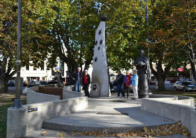
Hobart’s Abel Tasman monument, celebrating the Dutch seafarer’s 1642 discovery of the island that’s Australia’s bejewelled earring.
Abel Janszoon Tasman was born at Lutjegast, near Groningen, in the Netherlands in about 1603. In about 1632 he sailed for the East Indies and soon established himself as one of the most reliable skippers.
Hema HX-2+ Navigator – This is Australia! Brilliant both on road and off road!
After several successful expeditions he was appointed to command two ships, the Heemskerck and Zeehaen to explore southern and eastern waters. He discovered Van Diemen’s Land (Tasmania) making landfall just north of Macquarie Harbour on Tasmania’s wild west coast on 24 November 1642. He went on to discover New Zealand, the Tonga Islands, and some of the Fiji group. On his return, and after a couple more expeditions, he was rewarded with a backdated pay rise! He died in Batavia in 1659.
Tasman was a tenacious and able seaman and navigator. According to the Australian Dictionary of Biography, which is published by the Australian National University, ‘Tasman was a member of the Reformed Church. He was a brave and energetic mariner, a humane and properly cautious explorer, and a conspicuously able commander’.
Copyright © Fred Vanderbom
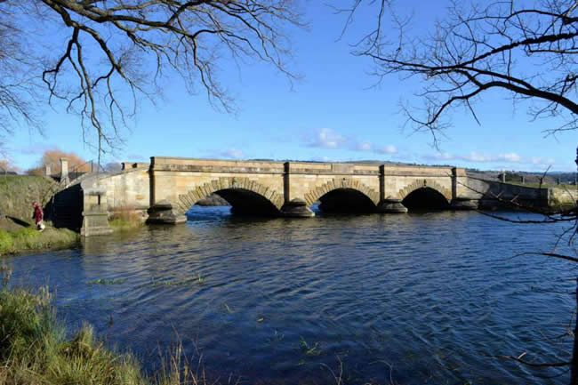
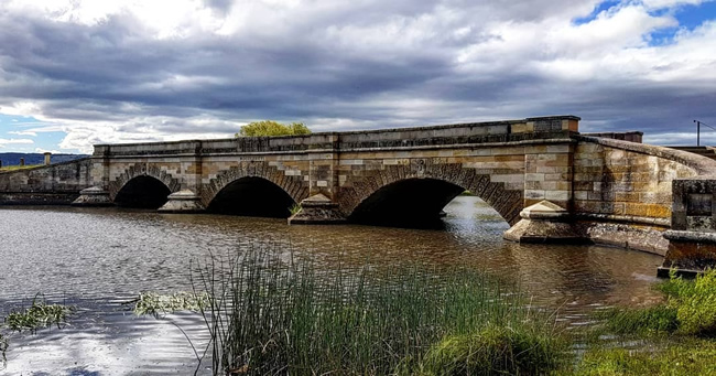
The bridge at Ross was built by convicts in the 1830s. The bridge has some historically significant friezes on the arches.
Copyright © A&N Schultink
The Ross Bridge was finished in 1836. After some lengthy delays in construction, the Governor George Arthur appointed James Colebeck and Daniel Herbert as overseers of the project. Wanting to get it finished he offered Herbert and Colebeck conditional pardons if they got it done quickly. That worked, because it was finished 18 months later.
James Colebeck was a master stonemason and did an excellent job. The bridge is still standing and in sound condition today, almost 180 years later. Daniel Herbert was the artist that did most of the friezes and carved designs, completing more than 80 of the 186 carved designs personally and having the rest done by other convicts under his supervision.
More info about the Ross Bridge and the Ross township at the Ross Visitor Information Centre website.
Copyright © Fred Vanderbom
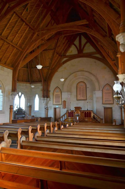
The interior of the late 19th century Ross Methodist church building (now Uniting) is wonderful.
The sandstone walls are hand carved, the ceiling is made from Oregon Pine, and the pews are made from Tasmanian Blackwood. But most importantly the gospel is preached there and praise is sung to Jesus regularly. That’s what churches are about – telling the story of Jesus and praising his name.
Copyright © Fred Vanderbom
Hema HX-2+ Navigator – This is Australia! Brilliant both on road and off road!
Copyright © Fred Vanderbom
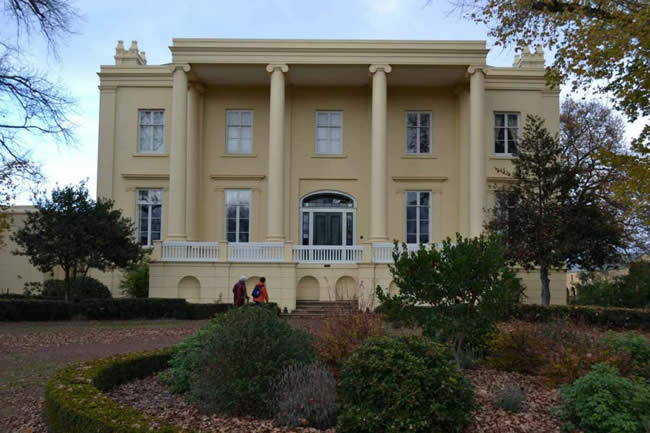
Just south of Launceston is “Clarendon” built by a successful agriculturalist in the 1830s. It has recently been much restored and now Australia’s largest Georgian mansion.
Copyright © Fred Vanderbom
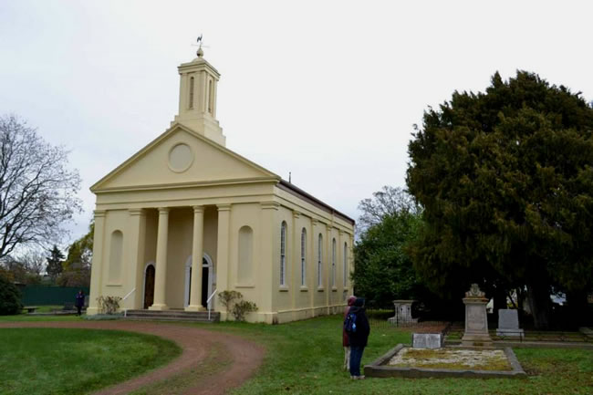
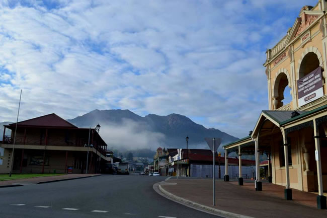
Evandale is close to Tasmania’s centre and also one of its oldest (early 19th century) towns.
This is the stylish St Andrews Church – built as a Presbyterian place of worship in 1838 and now a Uniting Church property.
Copyright © Fred Vanderbom
Queenstown Tasmania and Mt Owen – an old mining town that’s fallen on hard times despite the wealth under the ground.
Hema HX-2+ Navigator – This is Australia! Brilliant both on road and off road!
For a time I owned a couple of properties in Queenstown. One backed on to the town oval – the only AFL footy ground that I know of that has a gravel surface! Must have been hard on the knees of the players.
The surrounding hills are completely bald. All the vegetation was killed off years go because of toxic mining and smelting operations, and then of course the topsoil was washed away, making it difficult for vegetation to re-establish itself. But you can see it beginning, in gullies and cracks in the rocks. The vegetation will eventually return, re-establishing itself and providing an environment for the local fauna to also return.
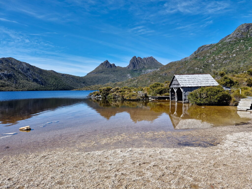
You can see clearly why it is called Cradle Mountain – it looks like a baby’s cradle! The Boatshed is in the foreground. A beautiful clear day – but the weather in this area is very changeable!
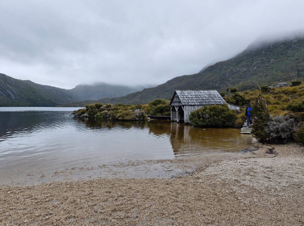
This photo of Cradle Mountain was taken the day after the one above! A very different weather, but still very beautiful!
Copyright © Fred Vanderbom
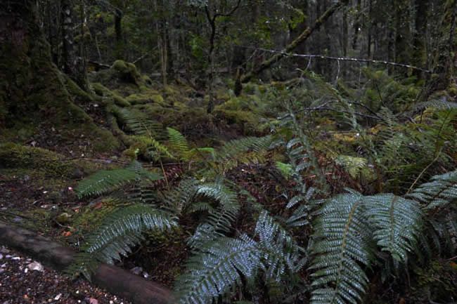
Copyright © Fred Vanderbom
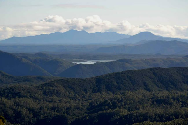
In many ways it is similar to the forests in the Otways Ranges in south-western Victoria.
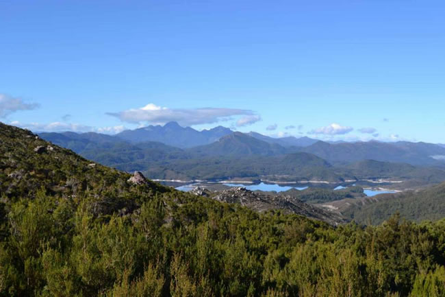
Copyright © Fred Vanderbom
Copyright © Fred Vanderbom
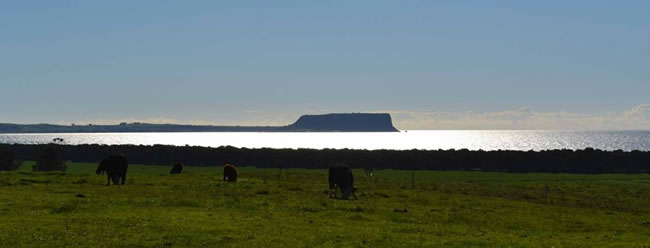
One Tasmania’s oldest towns is Stanley which shelters at the foot of “The Nut” in the state’s far north-west. It is still a centre for fishing and agriculture.
Stanley was also the home of the only Australian Prime Minister from Tasmania, Joseph Lyons. The house he lived in is still there. He was a member of the Tasmanian State Parliament for 19 years including 5 years as Premier.
In 1928 he won a seat in the federal Parliament for the Labor Party, but he became unhappy with federal Labor infighting and left to form the United Australia Party. The UAP won the 1931 election. He served as Prime Minister from then until he died of a heart attack in April 1939.
His wife, Dame Enid Lyons, who was the mother of their 11 children, followed him into politics in 1943. She was the first woman member of the Commonwealth Parliament and served there for eight years until her ill health forced her retirement.
More on Joseph Lyons at Australian History.
This page Copyright © ThisisAustralia.au


All the labels you use every day, with excellent service! EveryLabels.com.au
Hema HX-2+ Navigator – This is Australia! Brilliant both on road and off road!

