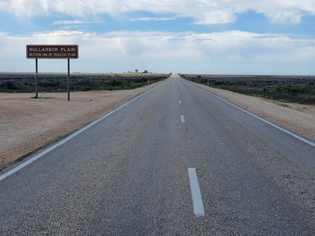
‘Crossing the Nullarbor’. An iconic drive for Australians. A delightful drive that weaves it magic as you go. The vastness as the sky and the horizons recede. Vast what fields and canola crops. Stunted, scrubby bushes. All looks grey and ordinary. Until you stop and look closely and see the incredible variety and beauty. Each bush its own little ecosystem.
In the 1950s and 60s it was a real challenge. The section of the Eyre Highway from Ceduna in South Australia to Norseman in Western Australia was unsealed. 1200 kilometres. About 750 miles. Crossing the Nullarbor then was a real expedition!
In the early 1970s the then Prime Minister, Gough Whitlam, was asked about getting the road sealed. He is reported to have said ‘Let them put their cars on the train!’ But by the mid 1970s the sealing of the road was underway. When I first crossed the Nullarbor in 1974 the road was sealed from Norseman to the state border just past Eucla. 380 kilometres of the road, from the state border to Penong, was still unsealed. And in July 1974 it was a wet, soggy, and muddy experience!
Its different now. The Eyre Highway, which stretches from Port Augusta at the northern tip of the Spencer Gulf in South Australia, to Norseman at the junction of the Coolgardie to Esperance Highway, is all sealed and in good condition. It is the main road between Perth, the capital of Western Australia, and the most isolated capital city in the world, and the rest of Australia – the ‘Eastern States’, as West Australian locals call it.
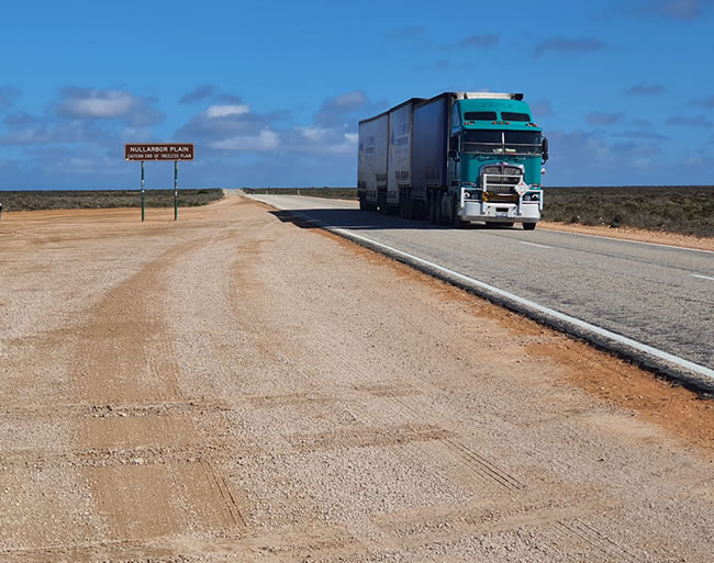
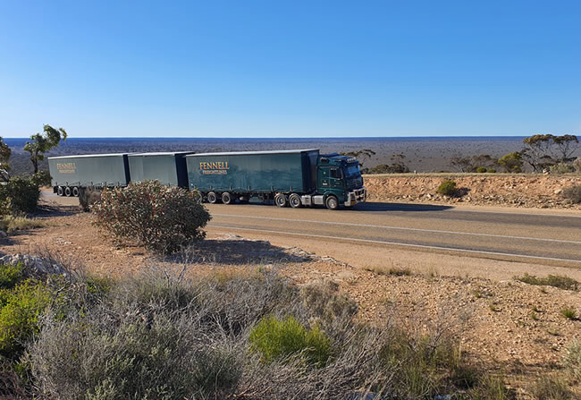
Trucks. Semi-trailers. Road trains. Lots of them, all the time. Carrying freight. The lifeblood of the nation. On the Eyre Highway. The main connector between east and west.

Copyright © Willem Schultink
To purchase a Hema map of the western section of the Nullarbor Plain, click here
To purchase a Hema map of the eastern section of the Nullarbor Plain, click here
Copyright © Willem Schultink
Copyright © Willem Schultink
To purchase a Hema map of the western section of the Nullarbor Plain, click here
To purchase a Hema map of the eastern section of the Nullarbor Plain, click here
Copyright © Luke Schultink
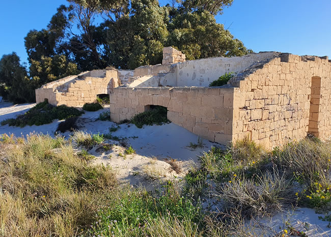
Fowlers Bay is a bay, town and locality in South Australia. The town is located on Port Eyre, at the western end of the larger Fowlers Bay. It was named Yalata after Yalata station, whose homestead was located on the hill nearby. The name Yalata now belongs to a small Aboriginal community further west.
Fowlers Bay was once an active port, but fell into decline in the 1960s and 1970s. Large sand dunes are prominent on the southern side of the town, and have been migrating to cover parts of the town over the past century.
I’m told that the fishing is great!
To purchase a Hema map of the western section of the Nullarbor Plain, click here
To purchase a Hema map of the eastern section of the Nullarbor Plain, click here
Copyright © Willem Schultink
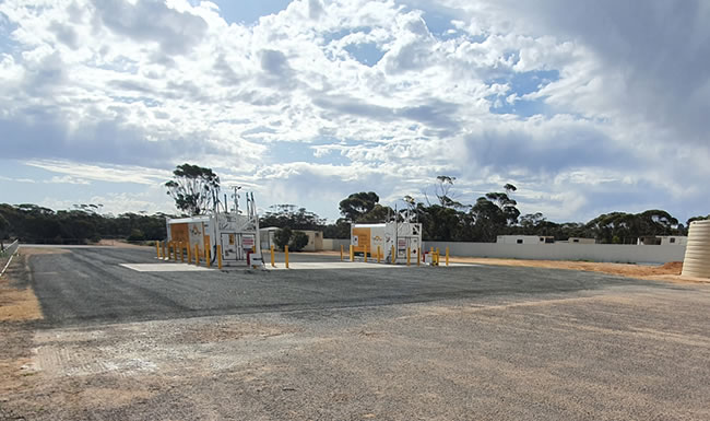
Perhaps fuel facilities like this will introduce some much needed competition for fuel prices on the Eyre Highway. This one is located on the site of the old Yalata service station which closed in about 2015.
Copyright © Willem Schultink
Trucks are the lifeblood of the nation, and the Eyre Highway is the main road connecting the east and west of the country.
To purchase a Hema map of the western section of the Nullarbor Plain, click here
To purchase a Hema map of the eastern section of the Nullarbor Plain, click here
Copyright © Willem Schultink
The trees you see in the distance are at the Nullarbor Station roadhouse. It is quite isolated, and has the most expensive fuel on the highway. But maybe with the advent of the new self serve fuel station at Yalata, with much lower prices, that will change.
Copyright © Willem Schultink
Copyright © Willem Schultink
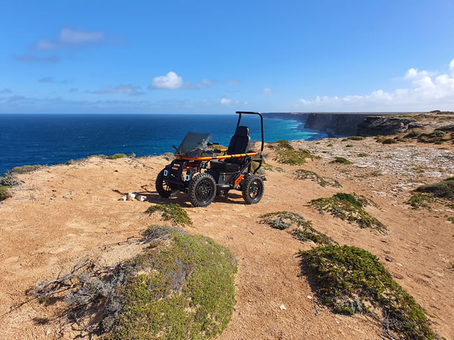
If you’d love to explore, but have limited mobility, you might want to check out the Terrain Hopper Overlander off road wheelchair / mobility scooter. Serious off road exploring capability!
Copyright © Willem Schultink
For more on the Eucla Telegraph Station click here.
Copyright © Willem Schultink
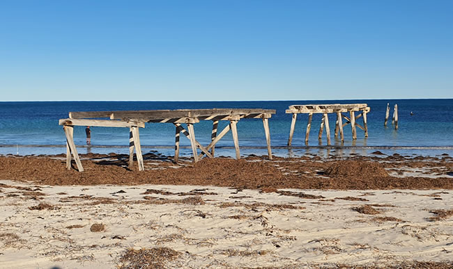
For more on the old jetty at Eucla, click here.
To purchase a Hema map of the western section of the Nullarbor Plain, click here
To purchase a Hema map of the eastern section of the Nullarbor Plain, click here
Copyright © Willem Schultink
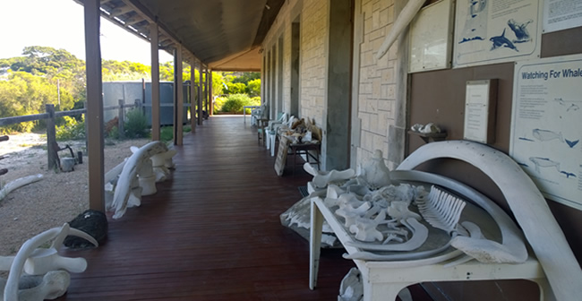
For more on the Eyre Bird Observatory, click here.
Copyright © Willem Schultink
At Eucla, just west of the state border, the road descends from the continental plateau down the escarpment through the Eucla Pass, on to the coastal plain. About 180 kilometres later it ascends again through the Madura Pass.
Copyright © Willem Schultink
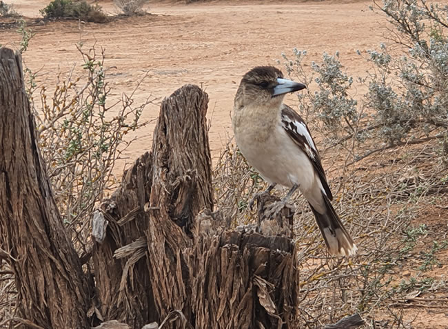
Kookaburras are terrestrial tree kingfishers native to Australia and New Guinea, which grow to between 28 and 47 cm in length and weigh around 300 grams. The distinctive sound of the laughing kookaburra’s call resembles human laughter. They are also sometimes referred to as the laughing jackass.
This pic was taken at the free campsite at Woorlba on the 90 mile straight between Caiguna and Belladonia in Western Australia. Complete with toilets and a dump spot.
Copyright © Willem Schultink
To purchase a Hema map of the western section of the Nullarbor Plain, click here
To purchase a Hema map of the eastern section of the Nullarbor Plain, click here
This page Copyright © ThisisAustralia.au
All the labels you use every day, with excellent service! EveryLabels.com.au