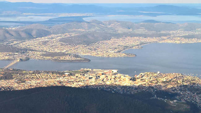
Tasmania’s natural beauty is undeniable, as these pictures from the east and south of Tasmania show. Hobart, the capital, is dominated by Mt Wellington. It is an imposing backdrop to the city, and the views from the top are spectacular. visitors are well catered for. Hobart, the destination port of the Sydney to Hobart ocean race, is defined by mountains and waterways, with great natural beauty around every corner.
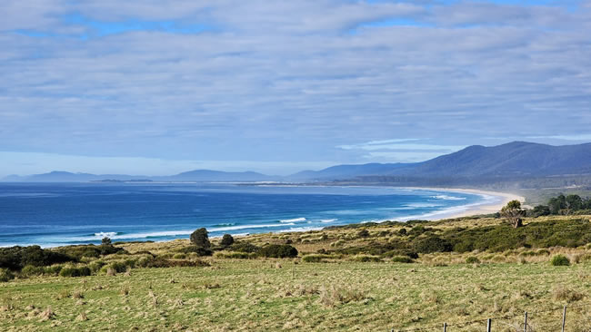
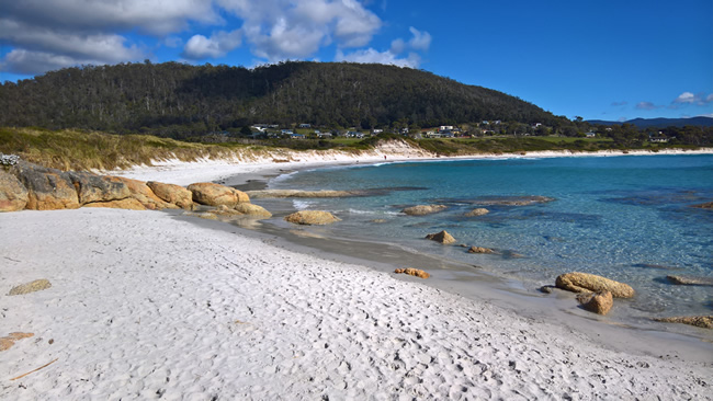
The east coast is justifiably a very popular holiday destination. Quiet, peaceful beaches, with clean sand in spectacular locations. Very different from the spectacular wildness of the west coast.

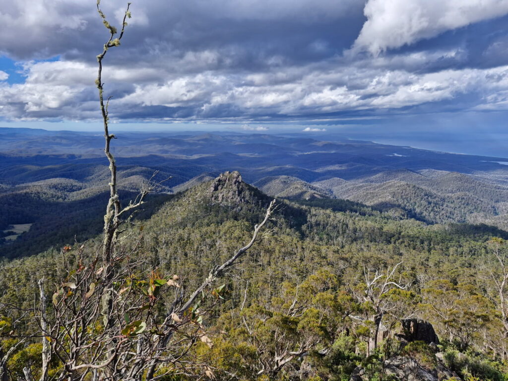
The climb up to the lookout is pretty rugged! You have to be fit and agile to do it! But the result is spectacular. The small coastal township of Scamander is just visible in the upper right of the picture.
Copyright © Willem Schultink
The afternoon stillness lends a magical quality to the backdrop of the Freycinet Peninsula to the beach and the water of the bay.
Copyright © Willem Schultink
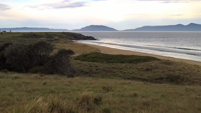
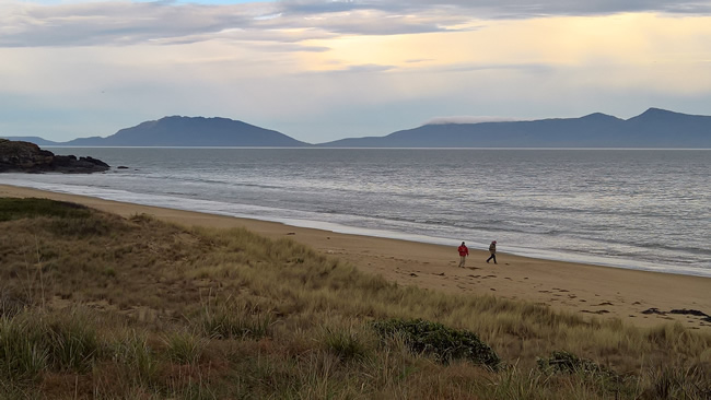
Beach walkers enjoying the afternoon stillness at Cressy Beach with the Freycinet Peninsula in the distance.
Copyright © Luke Schultink
Copyright © Willem Schultink
Redbill Beach is a truly beautiful spot. Bicheno is rightly regarded as a prime tourist/ holidaymaker destination on Tasmania’s east coat. This is a view of the beach with the town in the background. Just a short distance from the Blowhole.
Copyright © Willem Schultink
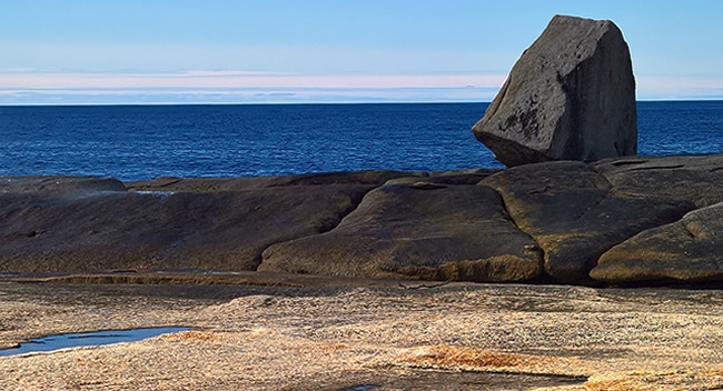
The east coast of Tasmania is very different from the west coat. The west coast is exposed to the ocean swell from thousands of miles of ocean, giving scenes of wild weather and spectacular beauty; the east coast is protected from those rugged conditions, giving a more peaceful beauty. As seas break onto these rocks they spout up out of the blowhole you can see to the left of the large rock in the picture. Even on a relatively quiet day like this the spout of water was quite marked. On a rough day with large swells it would be quite spectacular!
Copyright © Michael Ferguson Used by permission and with appreciation.
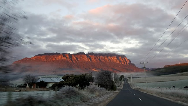
Michael Ferguson, the Tasmanian Minister for Health, was on the way to a cabinet meeting on a freezing cold morning, when he took this great shot of Mt Roland reflecting the morning sun. Wherever you drive in Tassie there is great beauty, and it is really great to see Tassie advancing economically again. They have recorded a population increase again this year, which can only be good!
The Hema HX2 Navigator. Navigate with confidence! The Hema HX-2 is a must have accessory that will go beyond any other GPS unit available in Australia.
Copyright © Jessica Prins
The photographer’s comment was simple ‘No words’. I just say ‘Wow!’ It’s a beautiful spot.
Bruny Island is separated from mainland Tasmania by the D’Entrecasteaux Channel. Storm Bay, the entrance to the Derwent river, is located to the island’s northeast.
Copyright © Willem Schultink
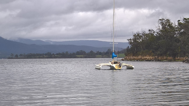
A trimaran rests like a bird on the still waters of Abels Bay at the mouth of the Huon River, south of Cygnet in southern Tasmania.
Copyright © Willem Schultink
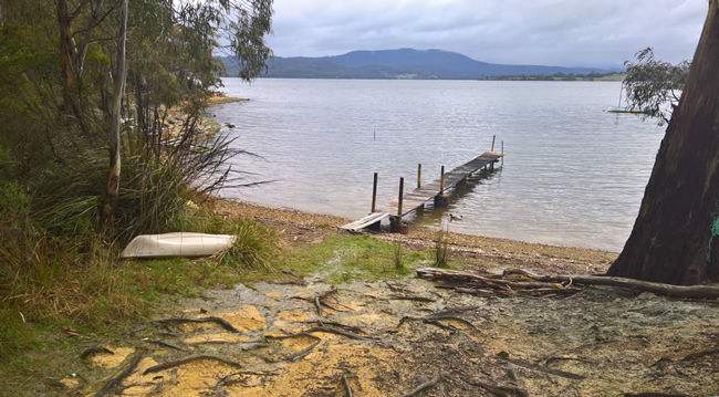
Abels Bay at the mouth of the Huon River, south of Cygnet in southern Tasmania is a quiet spot with a small community. A small community jetty makes it possible for fishing and sailing and kayaking activities.
Copyright © Helena Prins
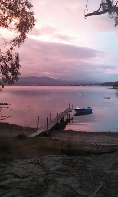
A peaceful scene in the pastel shades of evening light at Abels Bay, southern Tasmania.
Copyright © Willem Schultink
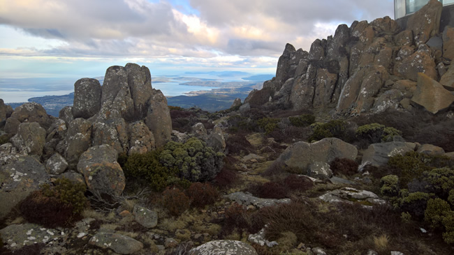
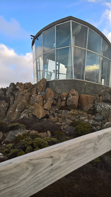
Mt Wellington at 1269 metres tall is the dominant feature of the Hobart skyline. The higher reaches are often covered in show, even at times in summer. There is a sealed road to the top, though it is quite narrow in places and care is needed when passing oncoming traffic. It is a very popular place for visitors, and there is extensive parking and an attractive glass enclosed lookout.
Mt Wellington was originally known as ‘Table Mountain’ a name given by Matthew Flinders in 1791 because it looks a bit like Table Mountain at Table Bay in Cape Town, South Africa. It was renamed ‘Mt Wellington’ in 1832 in honour of the Duke of Wellington who finally defeated Napoleon in 1815.
In this pic the sunlight slots between the clouds and lights up the city of Hobart, with the iconic Tasman Bridge on the left of the picture.
Copyright © Willem Schultink
Bruny Island and the d’Entrecasteaux Channel were named by the French explorer and navigator Bruni d’Entrecasteaux in 1792. He was the first European to sail up the river and map it.
You can see Bruny Island in the distance, and South Bruny Island in the far distance. They are joined by a narrow isthmus of land known as ‘the Neck’.
Copyright © Willem Schultink
The enclosed glass lookout at the top of Mt Wellington is much appreciated by visitors, especially on cold days! It gives spectacular views of Hobart and the surrounding areas. There is also a significant number of boardwalks – thoughtfully covered with anti-slip netting! – around the peak so visitors can go to different points to get different views.
Copyright © Willem Schultink
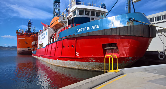
The Aurora Australis replaced the Nella Dan in 1990. (The Nella Dan was wrecked at Macquarie Island in 1987.) She is 94 metres long and displaces just over 8000 tonnes. She is capable of breaking ice of up to 1.2 metres thick at a speed of 2.5 knots. Owned by P&O she is usually chartered by the Australian Antarctic Division during the summer, but winters in Hobart. She has also been chartered by the Australian Navy. She has a hangar and helideck for three helicopters.
The Aurora Australis was replaced by Australia’s new Antarctic science and resupply ship, RSV Nuyina, in 2022.
Copyright © Jessica Prins
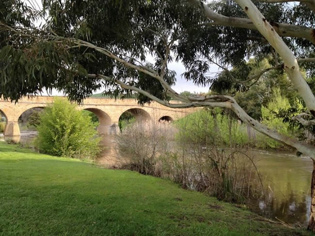
The Richmond Bridge is the oldest still working bridge in Australia, and the oldest stone arch bridge in Australia. Construction was started in 1823, when the foundation stone was laid, and finished in 1825. The bridge was built using convict labour. In 1832, George Grover, a deeply unpopular local gaoler because of his ferocity in flogging prisoners, was murdered by being pushed off the bridge. In 1885 the three middle piers had the larger cutwaters added, while the two outer piers did not.
This page Copyright © ThisisAustralia.au
All the labels you use every day, with excellent service! EveryLabels.com.au