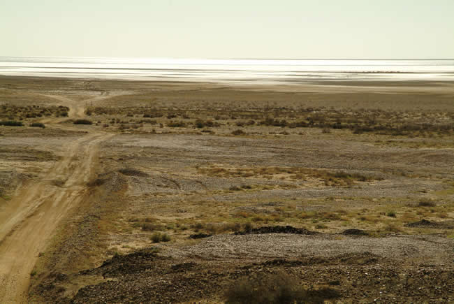
The stark beauty of Lake Eyre. The Oodnadatta Track. Marree, the end of the Birdsville track and the beginning of the Oodnadatta Track. Outback Australia.
 Joe Mortelliti‘s life long love, from when he was first given a Brownie camera as a boy, was photography. It was the focus of his work life for many years. He loved to travel with his wife Marion to as many parts of Australia as he could. He had the ability to ‘see’ the beauty of our land in such a way that he could photograph it for the delight of others. These photos are a legacy that he has left us. Used by permission and with appreciation.
Copyright © Joe Mortelliti Photography
When Lake Eyre does fill, it becomes temporarily Australia’s largest lake as it spreads out to 9500 square kilometres. This occurred only three times in the twentieth century, the latest being in 1989.
At its deepest, it reaches to almost six metres. The bed of Lake Eyre is also the lowest area in Australia, at seventeen metres below sea level.
To purchase a Hema map of Central Australia, click here
Copyright © Joe Mortelliti Photography
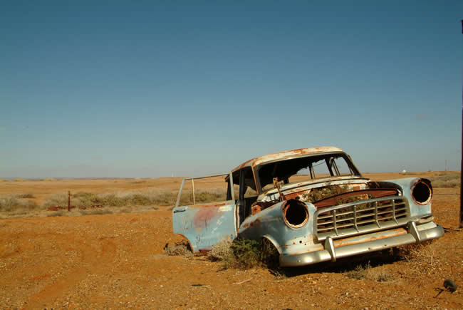
Marree was originally called Hergott Springs. It was the rail head of the old Ghan railway line. Camel strings operated out of Marree shifting goods to and from the rail head. Books refer to over 2,000 camels operating out of Marree.
It was also the last stop for this Holden so many years ago. How many times was the radiator topped up, the car jump-started or push started … until they finally gave up and started hitch hiking?
To purchase a Hema map of Central Australia, click here

Copyright © Joe Mortelliti Photography
Just north of Oodnadatta a memorial remembers all those involved in the construction of the Overland Telegraph Station between Adelaide and Darwin. Commemorating the place where the Overland Telegraph line changed course slightly and became a landmark along the track.
To purchase a Hema map of Central Australia, click here
Copyright © Joe Mortelliti Photography
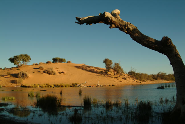
Originally known as the Queensland Road. We camped at the back of the Mungerannie Hotel and members of our party enjoyed a hot artesian spa.
The Great Artesian Basin is one of the largest artesian groundwater basins in the world. It underlies approximately one fifth of Australia.
To purchase a Hema map of Central Australia, click here
Copyright © Joe Mortelliti Photography
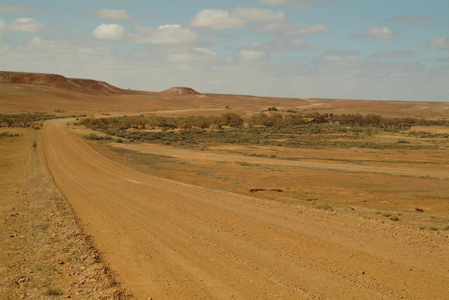
This shot was taken not far out of Marree. On the right you can see an example of one of the many large bridges from the Ghan railway that spans across countless floodways. Flash floods causing tracks to be washed away was a major reason for the railway being abandoned.
To purchase a Hema map of Central Australia, click here
Copyright © Joe Mortelliti Photography
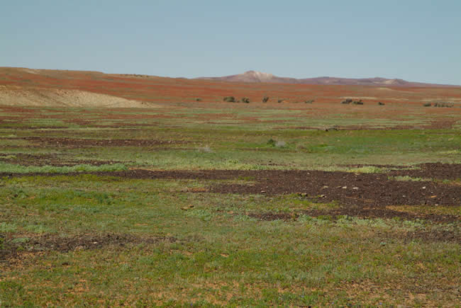
The harsh Outback continually presents changes of colour and shape across a very vast area that has to be travelled to experience how big it really is.
To purchase a Hema map of Central Australia, click here
Copyright © Koole Imaging
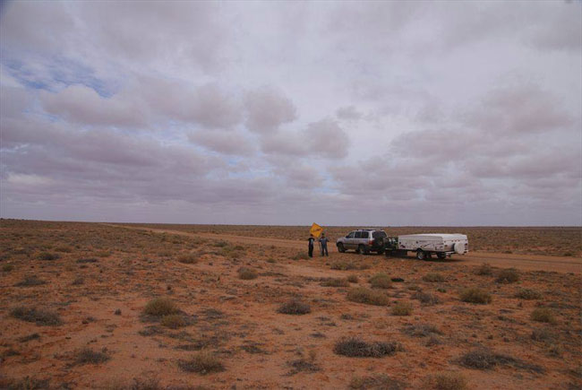
This pic really shows the desolateness of the land the Oodnadatta Track goes through. The barrenness, the isolation, the enormous silence. A very severe beauty.
To purchase a Hema map of Central Australia, click here
Copyright © Joe Mortelliti Photography
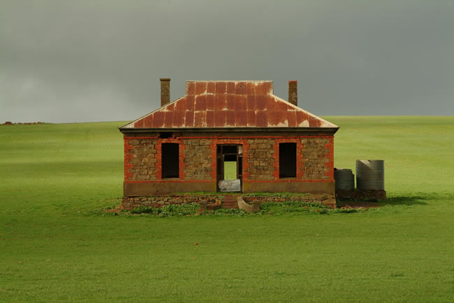
The ruins of stone cottages are dotted throughout the South Flinders Ranges. Set on the rolling green hills, the red stonework of the old cottages looks charming. A similar pic of the same building was used on the album cover of Midnight Oil’s ‘Diesel and Dust’
To purchase a Hema map of Central Australia, click here
Copyright © Joe Mortelliti Photography
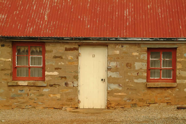
Quaint charming cottages are to be seen everywhere in Burra. The town boasts the oldest cottages in Australia. The township has a host of delightful bed and breakfast cottages available.
To purchase a Hema map of Central Australia, click here
Copyright © Joe Mortelliti Photography
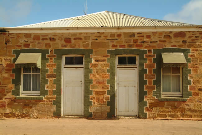
Terowie is a small township (population 220) It came into existence as part of the railway network which was built in South Australia in the late 19th century. It has a large number of interesting and significant historic houses.
To purchase a Hema map of Central Australia, click here
Copyright © Joe Mortelliti Photography
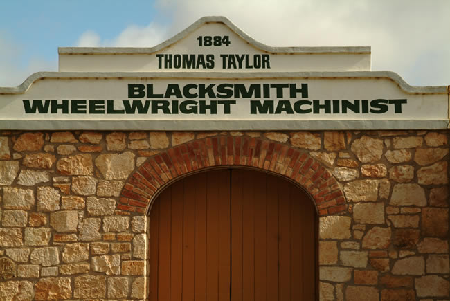
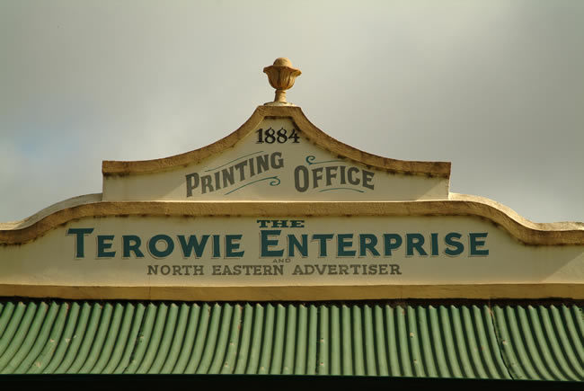
Terowie has been designated an historic town because of its large number of untouched 19th century buildings. Charming old buildings from the 1880s like the old print shop, hardware store and blacksmith’s shop line the main street.
To purchase a Hema map of Central Australia, click here
Copyright © Joe Mortelliti Photography
Terowie was founded in 1877 and was a railway town until 1989. It served as a military camp from 1941 to 1946.
To purchase a Hema map of Central Australia, click here
This page Copyright © ThisisAustralia.au
All the labels you use every day, with excellent service! EveryLabels.com.au