Grampians National Park (Gariwerd), Victoria, Australia
The Grampians National Park (Gariwerd) is about 235 kilometres west of Melbourne. It is Australian National Heritage List because of its natural beauty and the indigenous rock art sites. The name Grampians was given by Sir Thomas Mitchell, who was the Surveyor General of New South Wales, in 1836, after the Grampians Mountains in Scotland. The name Gariwerd is from one of the local Australian Aboriginal languages. The highest peak is Mount William at 1167 metres.

Copyright © Joe Mortelliti Photography
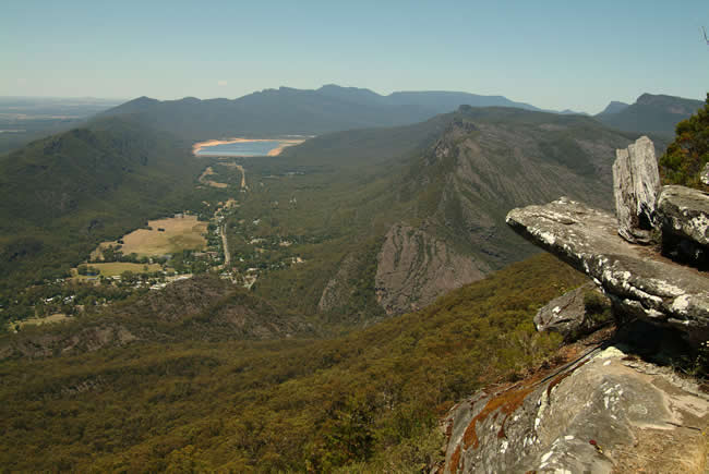
The view over Halls Gap from Boroka lookout. On the range to the right is the area known as the Elephant Hide.
Copyright © Koole Imaging.
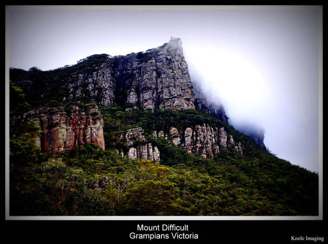
The Mt Difficult Range stretches between Roses Gap and Halls Gap enclosing Lake Wartook. The terrain of the mountains is, as the name suggests, very rugged with high, often overhanging cliffs surrounding the range. Mt Difficult is on the NW side of the range and offers several great walks.
Camping Guide to Victoria – This is Australia! – Camping all around Victoria!
More info on the Grampians at Big Ben’s Victoria
Copyright © Willem Schultink
We explored a number of tracks on the western side of the Grampians.
Among other things we saw the famous ‘black cat’, said to be an escaped puma or some other large cat. We reckon this one was a large feral cat, though it was big for a cat. It was black all over. It loped across the road maybe four or five lengths in front of the car. We were on a gravel track travelling at maybe 50 kmh. The cat was gone into the bush before we had time to get out the camera.
Copyright © Willem Schultink
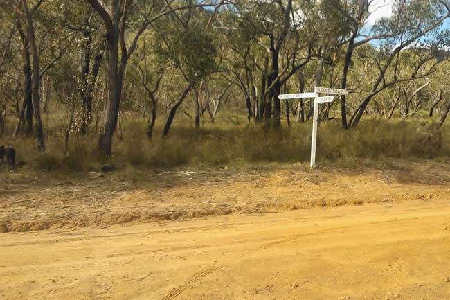
Junction of Asses Ears Road, Redrock Road, and Lodge Road.
The name Asses Ears Road comes from the explorer Major (later Sir) Thomas Mitchell, who named one of the ranges in the Grampians the Asses Ears Range, after a mountain he surveyed on the island of St Helena in the South Atlantic Ocean.
Copyright © Willem Schultink
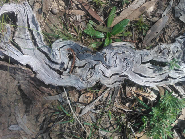
A variety of interesting shapes and patterns make for an interesting image. Exotic weeds compete with native plants for space.
Camping Guide to Victoria – This is Australia! – Camping all around Victoria!
Copyright © Willem Schultink
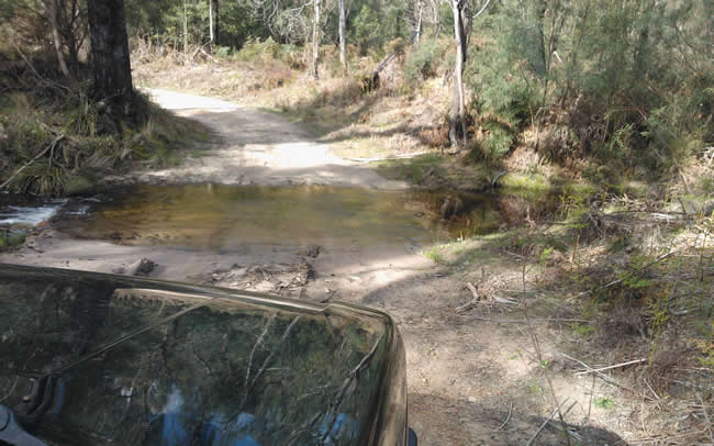
A creek flows over the track as we approach the Grampians. The reflections of the forest on the bonnet of the car show a further part of the forest that is out of the main picture.
We had already staked a tyre a little while before and therefore didn’t have a spare, so we were being careful. But this was no problem at all. The track became rougher as we went, but presented no real problems. More interesting was that no replacement tyre was available in Halls Gap or Stawell, so we had to keep the spare on till we got home a few days later.
Copyright © Willem Schultink
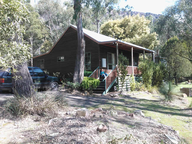
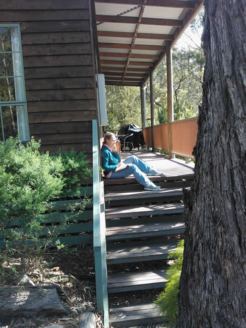
One of the many holiday homes available to rent in Halls Gap. Country Lane Cottage was first rate, in a lovely setting, with first rate up to date fittings.
More information on Country Lane Cottage.
Copyright © Willem Schultink
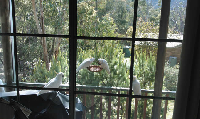
These sulphur crested cockatoos visited us daily – the seeds provided for them in the feeder was no doubt the main attraction. They were quite tame and you could approach them closely …. but be careful! They have a powerful beak which can do some serious damage to your finger.
Sulphur crested cockatoos (scientific name Cacatua galerita) live throughout northern and eastern Australia including Tasmania, with a small colony of them in Perth, Western Australia. They feed on berries, seeds, nuts and roots, and are not averse to taking food from humans, as you can see in the pic above. Males and females are very similar, but males have a darker eye colour – more brown compared with the female’s more red eye colour. As noted above they have a powerful beak, and in some areas have become a pest by damaging balconies and other timber house fittings with their beaks.
More information on sulphur crested cockatoos.
More information on Country Lane Cottage.
Copyright © Willem Schultink
Just over a kilometre from the Halls Gap town, but in a bush setting. A quiet place, to refresh the soul. Country Lane Cottage suited us well.
More information on Country Lane Cottage.
Copyright © Luke Schultink
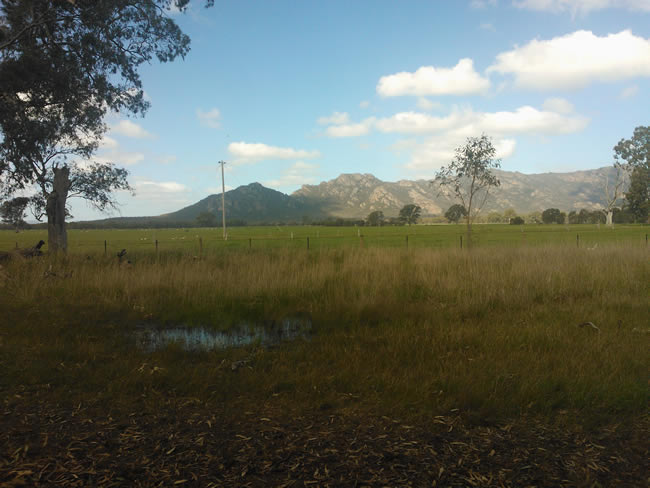
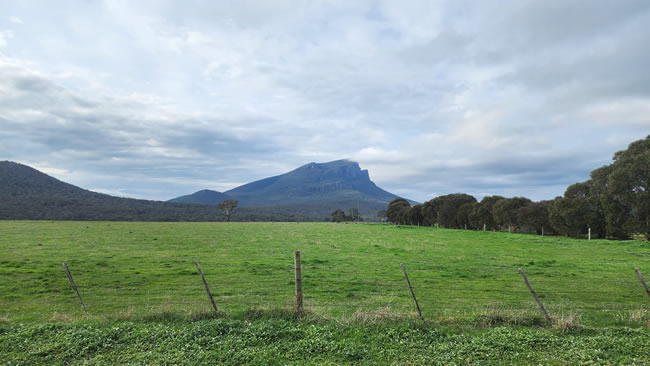
Dunkeld is in the centre of an agricultural and winery region and is surrounded by rich pastoral land. This is a view of Mount Sturgeon at the southern end of the Grampian Ranges. The Grampians Road leads directly north to the holiday village of Halls Gap at the northern end of the Grampians.
This page Copyright © ThisisAustralia.au
All the labels you use every day, with excellent service! EveryLabels.com.au
Camping Guide to Victoria – This is Australia! – Camping all around Victoria!