Victoria’s west coastal areas, from Warrnambool to the South Australian border. Part of the iron bound south coast of Australia that includes the vast miles of cliffs on the Great Australian Bight. A spectacular and rugged coastline that has few safe harbours. Portland is a main one, and it is the oldest European settlement in Victoria, though there were settled tribes of Aboriginal people there a long time before the Europeans came.
Portland Bay was named in 1800 by James Grant, sailing in the Lady Nelson, who named it after the Duke of Portland. Portland is the only deep sea port between Adelaide and Melbourne. It offers a sheltered anchorage against the wild weather that is so common in the Bass Strait.
It didn’t take long for the whalers and sealers to establish a base there, given it was the only safe harbour for many miles. But the first permanent settlers of European heritage were Edward Henty and his family, who arrived in 1834 after stints in Western Australia and van Diemen’s Land (Tasmania). This was an illegal settlement because the British Colonial Office wanted to contain settlement within certain limits. Not that that stopped the Hentys! The Colonial Office was still trying to work out how to deal with the indigenous inhabitants of Australia.
Victoria State Map – This is Australia! A great and useful travellers’ map of Victoria
Edward Henty was just 24 years old when he arrived in Portland, and using a plough he made himself was the first white man to plough the ground in Victoria.
Given Portland’s unique position as the only deep-water port between Adelaide and Melbourne, it seems to me that there needs to be a focus on developing it as a major regional centre and transport hub, servicing both the south eastern part of South Australia, and the western part of Victoria.
 Joe Mortelliti‘s life long love, from when he was first given a Brownie camera as a boy, was photography. It was the focus of his work life for many years. He loved to travel with his wife Marion to as many parts of Australia as he could. He had the ability to ‘see’ the beauty of our land in such a way that he could photograph it for the delight of others. These photos are a legacy that he has left us. Used by permission and with appreciation.

Copyright © Joe Mortelliti Photography
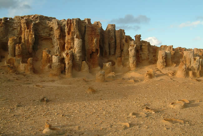
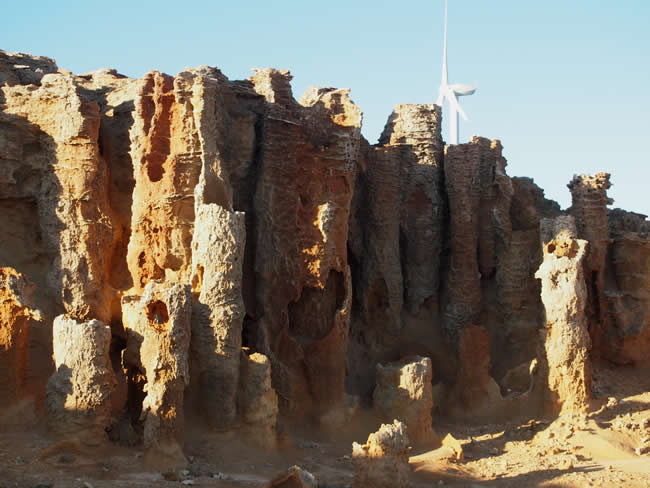
Located at Cape Bridgewater, this austere landscape is beautiful. An accepted theory is that a forest of Moonah trees was smothered by a large sand dune. Water seeping down through the sand formed a crust of sandstone on the outside of the trunks. The trunks decayed leaving behind petrified trunks.
Hmm. Might be an ‘accepted theory’, but if you look at the picture you have to wonder how so many trees grew so close together. It would seem a more reasonable theory to say that they were washed into a localised area by a catastrophic large water movement of a massive flood, and rapidly buried with sand as part of that same turbulent event.
There is an interesting discussion of the Yellowstone petrified forests in the Yellowstone National Park in the United States at Creation.com. The petrified forests at Yellowstone are similar but not the same as those at Cape Bridgewater, but there are significant parts of the discussion that are very relevant.
Copyright © Willem Schultink.
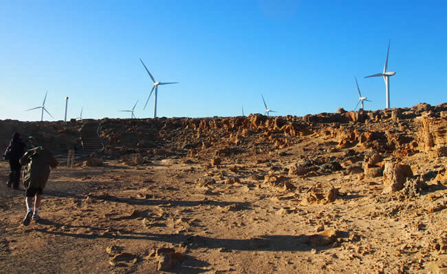
Ten years later the austere landscape is still beautiful. But now there is a large wind farm just a few hundred metres away. Everywhere you look, except looking out to sea, you see wind turbines.
If you would love to visit places like this, but have mobility issues, you might like to visit the Overlander Mobility website.
Copyright © Willem Schultink.
It’s quite a fantastic – and windy! – place to walk, with wind turbines adding a surreal aspect to the stark, arid rockscape. Note the broken wind turbine minus its fan on the left of the picture.
Victoria State Map – This is Australia! A great and useful travellers’ map of Victoria
Copyright © Willem Schultink
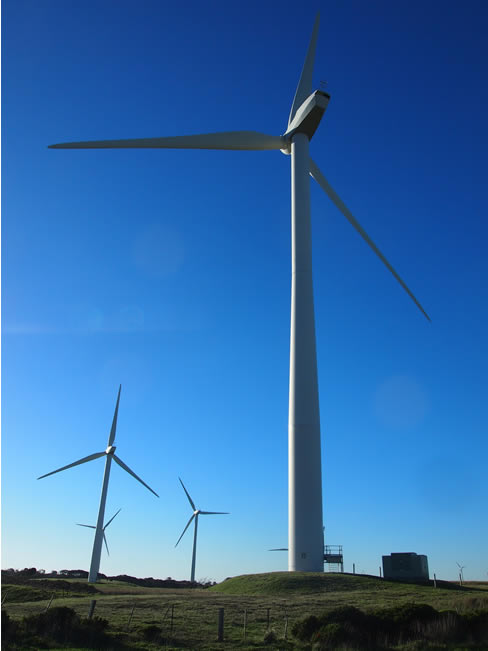
There are 29 2 megawatt wind turbines at the Cape Bridgewater wind farm. They dominate the landscape.
While we were there we took the time to observe the effects of the turbines on the environment. Much is said about the low frequency noise, less about the effects of moving shadows. Both are present.
There are two noises that predominate. The long slow whoosh, whoosh, whoosh … as the blades move through the air, and the continuous grind of the gearboxes in the nacelles high above. It must be remembered that each of these nacelles is a 30 tonne industrial installation. The combined noise of the 25 turbines (one was broken and minus its fan; three others were not working) is significant.
The other noticeable effect was the shadows of the blades moving constantly over the ground. We only noticed this after a while of being there, but we did find it somewhat disconcerting. In the early morning or late afternoon these shadows can be a long way – kilometres – from the turbines themselves. It would be interesting to see a study of the effects, if any, of the shadows movement on wildlife in the area.
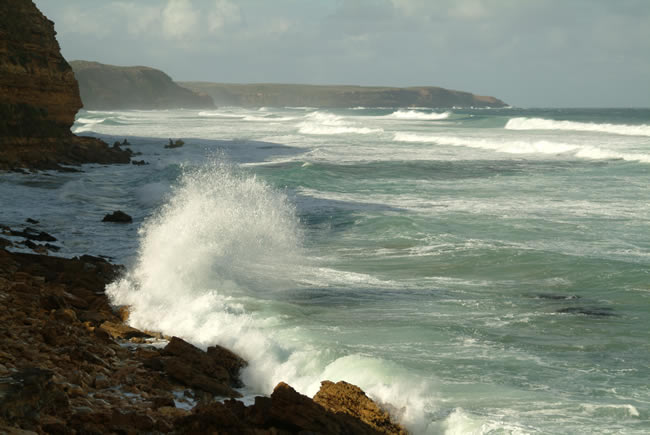
Copyright © Joe Mortelliti Photography
Down on the beach at Nelson Bay looking toward Cape Sir William Grant. The rough seas churning the water white.
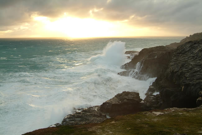
Copyright © Joe Mortelliti Photography
The sun starts to set as powerful seas smash into the cliffs. The volcanic black rock at the base of the cliff is formed mainly from basalt, and scoria which is purple in colour.
Scoria is a highly vesicular – that means that it is full of holes, like a sponge – , dark coloured volcanic rock that may or may not contain crystals. It is typically dark in colour, generally dark brown, black or purplish red, It is related to basalt and is often found near basalt rocks.
The rocks at Cape Bridgewater near Portland are made up of both basalt and scoria, plus lots of limestone in the area of the Petrified Forest.More info on scoria and basalt in Wikipedia
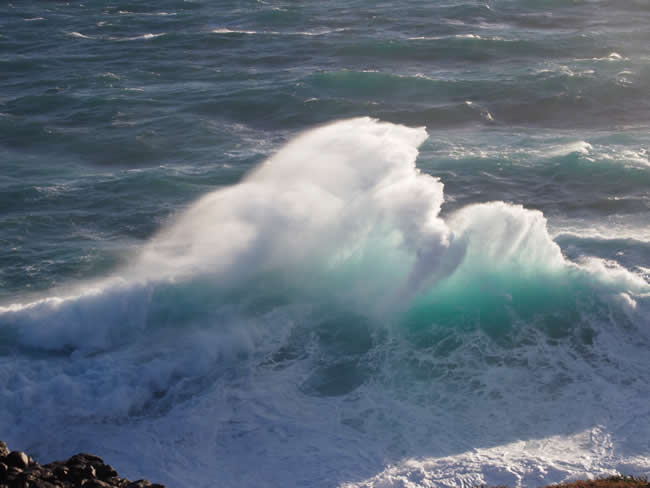
Copyright © Willem Schultink
A breaker thunders onto the rocks and then the water recedes back to the sea. When this backwash of water meets the next breaker coming the collision produces spectacular results!
Victoria State Map – This is Australia! A great and useful travellers’ map of Victoria
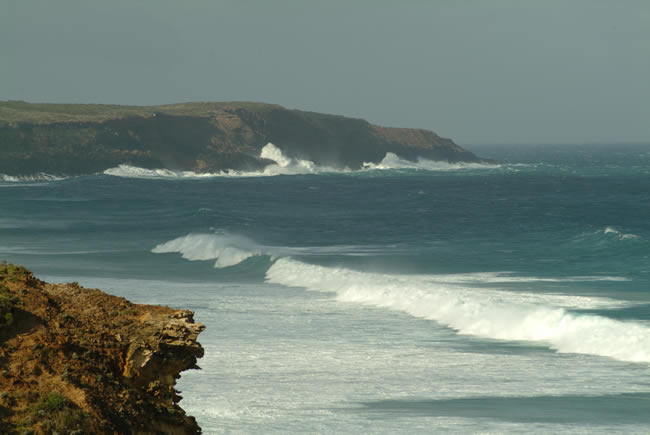
Copyright © Joe Mortelliti Photography
This cape flanks Nelson Bay at Portland. The seas were heavy and we watched excitedly with friends as the seas constantly climbed the massive cliffs of the cape.
Wind farms in the Portland area.
The Portland wind farm is one of Australia’s largest wind farms. It is located on four sites: Cape Bridgewater, Cape Nelson, Cape Sir William Grant, and Yambuk, near Port Fairy. Three of the four sites have been completed; the Cape Sir William Grant part of the project is not done as yet, and there appears to be some doubt about whether it will go ahead. The project was supposed to generate 195 megawatts of electricity when it is all complete, but the non completion of the last stage means that that cannot be reached at present. The total project cost is $330 million, much of which has been met by the taxpayer through government subsidies.
The project was controversial, with the wind towers on the three capes being approved by the planning minister against the recommendations of the a Victorian Civil and Administrative Tribunal hearing and of a government appointed panel.
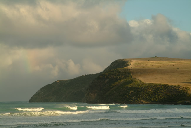
Copyright © Joe Mortelliti Photography
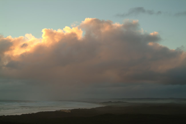
The sun sinks low after a rain storm at Cape Bridgewater. This spot is the highest cliff face on the Victorian coast.
This is also an historic photo. Now that a wind farm has been established here this scene will be quite different. I will be visiting this area in the next few weeks to have a look and take some photos. I will post some of them here so that we can compare the before and after.
If you have pics of this area you’d like to have up here, please contact us.
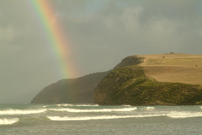
Copyright © Joe Mortelliti Photography
Rain, rainbows and rough seas. This is the highest cliff top on the Victorian coastline, 130 metres above sea level. The beach here is 4 kilometres long.
Just before taking this shot rough seas rapidly filled the beach right in front of us, rose over a one metre embankment into the car park and lapped the walls of the kiosk. Moments later there was fifty metres of sandy beach again in front of us. Locals at the kiosk had never seen this happen before and luckily no one was on the beach during this freak of nature.
Hmm. That sounds like the effects of a tsunami to me. Could be the result of an earthquake thousands of miles away.
Victoria State Map – This is Australia! A great and useful travellers’ map of Victoria
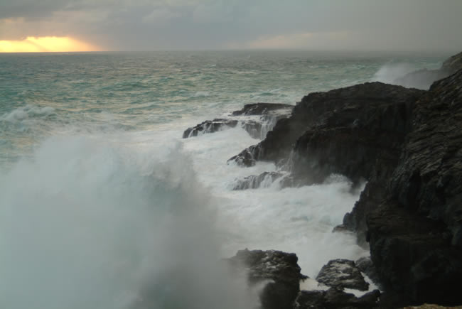
Copyright © Joe Mortelliti Photography
This is the wildest place we have visited. Spray from the waves comes over the tops of the 80 foot (25 metres) high cliffs. I really needed a waterproof camera here!.
Historical notes from the 1880s record that the blow holes sounded just like cannons and could easily be heard at Portland 19 kilometres away. The actual holes have since collapsed but the spectacle is still awesome.
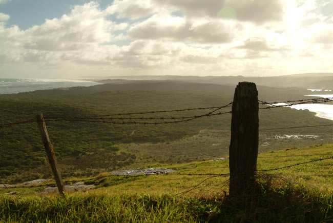
Copyright © Joe Mortelliti Photography
The bay spans all the way around to the South Australian Border. A vast stretch of unspoilt ocean beach, huge rolling sand dunes and lakes.
Shot from up high in harsh noon light from the edge of Cape Bridgewater looking toward the South Australian border.
Copyright © Joe Mortelliti Photography
Discovery Bay is rimmed by an expanse of sand dunes.
Further around the coast near Swan Lakes the Portland buggy club have access to the sand dunes, and you can drive 4WD vehicles down onto the beach.
This page Copyright © ThisisAustralia.au


All the labels you use every day, with excellent service! EveryLabels.com.au
Victoria State Map – This is Australia! A great and useful travellers’ map of Victoria

