Melbourne. Victoria’s capital city, situated on Port Philip Bay. A few scenes from around Melbourne.
 Joe Mortelliti‘s life long love, from when he was first given a Brownie camera as a boy, was photography. It was the focus of his work life for many years. He loved to travel with his wife Marion to as many parts of Australia as he could. He had the ability to ‘see’ the beauty of our land in such a way that he could photograph it for the delight of others. These photos are a legacy that he has left us. Used by permission and with appreciation.
Copyright © Joe Mortelliti Photography
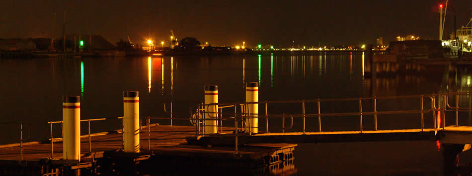
Night lights create a warm mood. Beyond the boat landing are the lights of Williamstown.
Copyright © Joe Mortelliti Photography
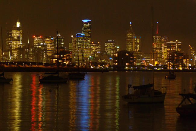
The view from Williamstown toward the city center as Melbourne lights up for the night. Photographed on a relatively still night so as to capture the city lights reflecting in the water.
Victoria State Map – This is Australia! A great and useful travellers’ map of Victoria
Copyright © Fred Vanderbom.
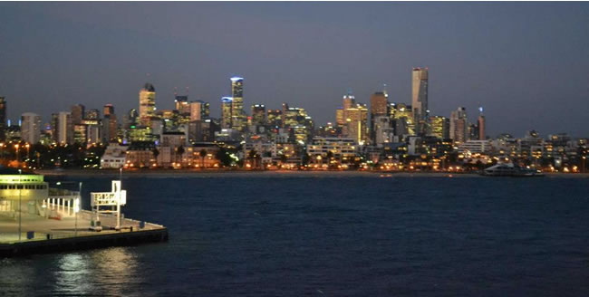
As the Spirit of Tasmania departs Station Pier in Melbourne, this is what you see. Melbourne from Port Philip
Interesting to see the changes in the skyline in 10 years.
Copyright © Willem Schultink.
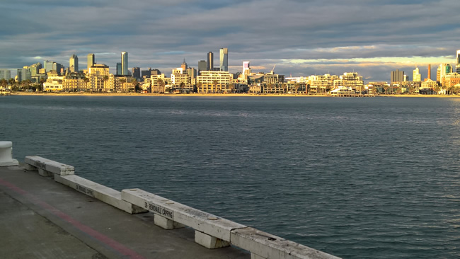
On a spring evening, from Melbourne’s Station Pier. The city is brilliantly lit up by the evening sun peeking under the clouds.

Copyright © Joe Mortelliti Photography
This little white fishing boat in the shadow of the HMAS Castlemaine” creates a David and Goliath contrast.
HMAS Castlemaine is one of the sixty Australian-built Bathurst Class corvettes to serve throughout World War 2, and is the last one still afloat. She has been restored by volunteers over four decades. During World War 2, she travelled some 117,000 miles (216,000 kilometres). In the process she circumnavigated Australia and enduring the constant threat of sea and air attacks, visited China, Indonesia, Papua New Guinea, the Philippines, the Solomon Islands.
Victoria State Map – This is Australia! A great and useful travellers’ map of Victoria
HMAS Castlemaine was built in Williamstown and launched on the 7th of August 1941 – so it is quite appropriate that she is permanently berthed at Gem Pier in Williamstown.
More info on the HMAS Castlemaine can be found at HMAS Castlemaine
Copyright © Joe Mortelliti Photography
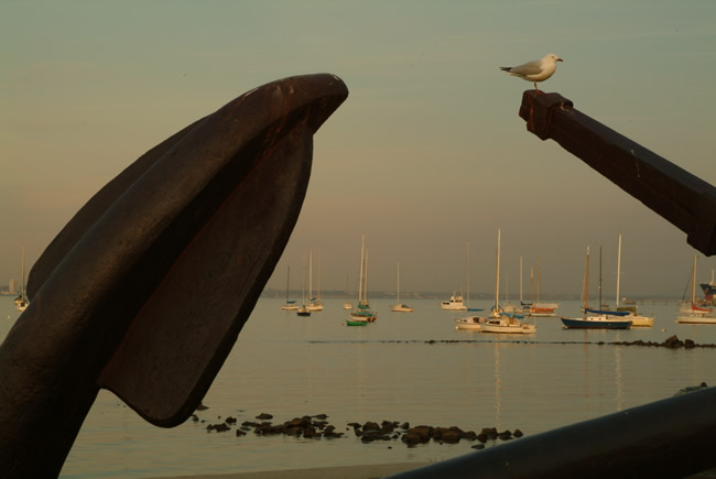
As the sun settles low in the sky this gull settled on this scene adding a little extra charm.
Copyright © Joe Mortelliti Photography
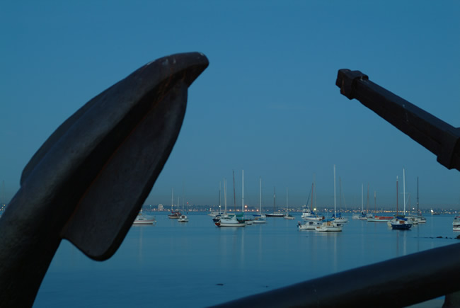
Dusk settles at Williamstown, viewing the boats in the harbour through the anchor provides a window with a sense of depth.
Copyright © Joe Mortelliti Photography
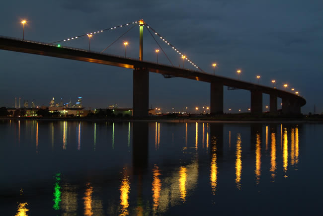
The Melbourne city skyline lights up beyond West Gate Bridge at dusk. The Bolte Bridge can be seen at the far left.
Copyright © Mark Almond
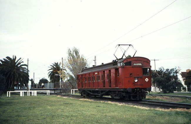
The Melbourne railway system has served the city well over many years. It has come a long way since this pic was taken. This was a Sunday train service with just one carriage, and ran close by Altona Beach and you could smell the seaweed. Hence the name Seaweed Express!
Victoria State Map – This is Australia! A great and useful travellers’ map of Victoria
Copyright © Joe Mortelliti Photography
On the outskirts of Melbourne a break in the clouds bathes land mark trees on the hill side at Lilydale Lakes with sunshine.
Copyright © Willem Schultink
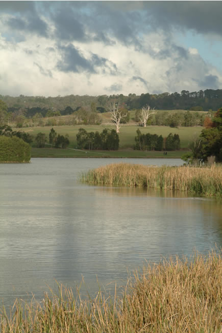
Part of the Blackburn Lake Sanctuary. The Lake itself was formed by the damming of Gardiner’s Creek in 1889 to enhance land values in the area, and to provide water for orchards. The company that developed the area also built a jetty and cafe, with row boats for hire. Visitors came from Melbourne on a steam train. A model township was planned, but the housing plans did not work out, though parts of the original layout remain.
Australian artist Frederick McCubbin painted some of his best known paintings, including “Down on his Luck” and “The Bush Burial”, in the area. In 1909 the Adult Deaf Society purchased the lake and about 30 hectares of land and established a home for deaf people. They built a home there and established a flower farm, which grew vegetables as well as flowers, for sale at the Victoria Markets.
The lake area was also used during WW1 for recuperation for wounded soldiers.
Beginning in 1938, when the Blackburn Progress Association wanted to acquire the land for a public reserve, there has been a steady progress in protecting the area and making it a sanctuary. A total of 25.8 hectares now make up the sanctuary.
It is indeed a very pleasant place to be and to relax. Walking tracks, picturesque bridges, bush, lake, barbecues, visitor centre…
Victoria State Map – This is Australia! A great and useful travellers’ map of Victoria
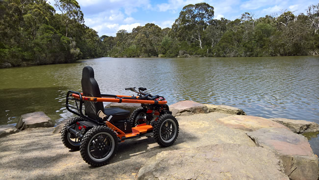
The picture shows a four wheel drive wheelchair on Duck Point.
This page Copyright © ThisisAustralia.au
All the labels you use every day, with excellent service! EveryLabels.com.au