Geelong region and towns.
 Joe Mortelliti‘s life long love, from when he was first given a Brownie camera as a boy, was photography. It was the focus of his work life for many years. He loved to travel with his wife Marion to as many parts of Australia as he could. He had the ability to ‘see’ the beauty of our land in such a way that he could photograph it for the delight of others. These photos are a legacy that he has left us. Used by permission and with appreciation.
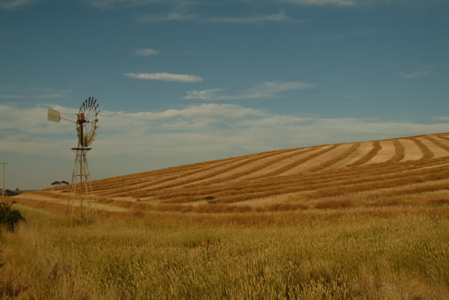
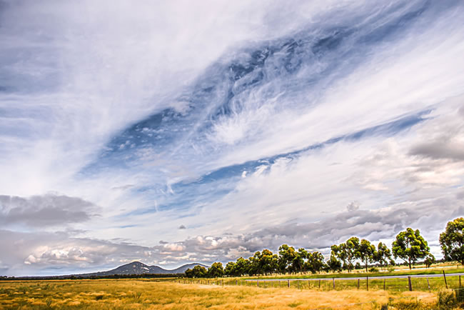
Windmills remind us of how dry our country is. The rolling hills of Barrabool on the edge of Geelong have been a favourite place for photographers to visit. I have not been able to find out why the farmer created the patterns in his field.
Copyright © Joe Mortelliti Photography
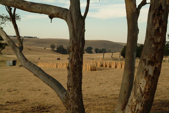
The rolling Barrabool Hills near Geelong. I always liked seeing the rolls of hay bales in the countryside and I enjoyed adding depth to the scene by capturing them through the trees.
Copyright © Joe Mortelliti Photography
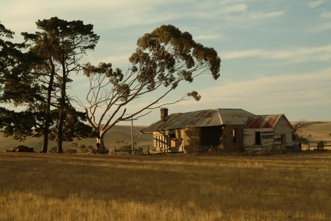
An old farm house in the Barrabool Hills near Geelong. The charm of old farm properties always attracts. Captured during a dry summer the warm evening sunlight adds a golden glow to the scene.
Hema HX-2+ Navigator – This is Australia! Brilliant both on road and off road!
Copyright © Joe Mortelliti Photography
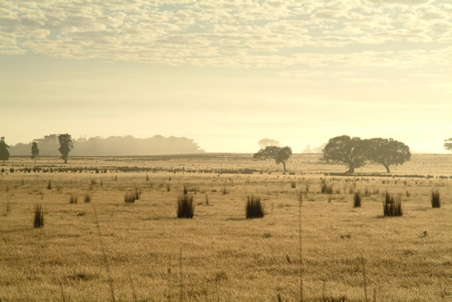
This was my first exposure with a new professional digital camera. It was a quick response to seeing the misty morning over the fields below Mt Duneed.
Victoria State Map – This is Australia! A great and useful travellers’ map of Victoria
Copyright © Joe Mortelliti Photography
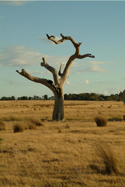
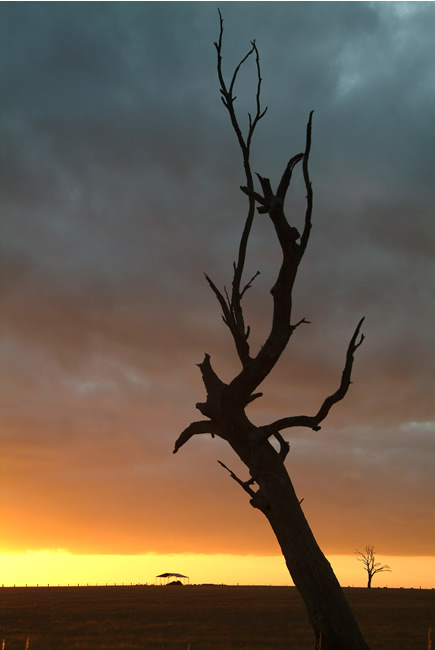
Driving along a dry weather only road this dead tree off Horseshoe Bend Rd, near Mt Duneed, looked dramatic as the sun started to set late in the afternoon. Standing out against the dry summer grass, and having had many years of drought, it conveyed the harshness of our land.
Copyright © Willem Schultink
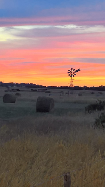
The windmill silhouetted against a spectacular sunrise caught my attention as I was driving home. I just had to stop and get an image. Hay bales in the foreground add depth and interest.
Victoria State Map – This is Australia! A great and useful travellers’ map of Victoria
Copyright © Joe Mortelliti Photography
Our Australian landscape is dotted with hay sheds, and as a part of this landscape picture, reminds us of our harsh dry continent.
Copyright © Joe Mortelliti Photography
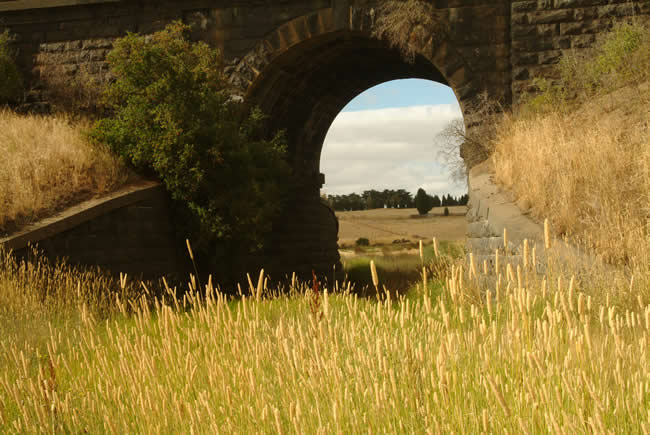
Sun burnt grasses and dry summer pastures are part of our Australian summer. The old railway bridge ties these elements together in this landscape near Gheringhap.
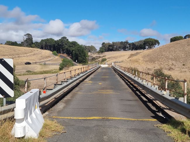
The road deck of the old Pollocksford Rd bridge, just off the Hamilton Highway, near Geelong. It is looking to be in poor condition. The bridge has now been closed, at least for the time being. It will most likely be repaired towards the end of 2025 and early 2026. One of the reasons for it being closed was that heavy vehicle owners ignored the 3 tonne load limit signs, and the maximum speed of 10 kilometres per hour.
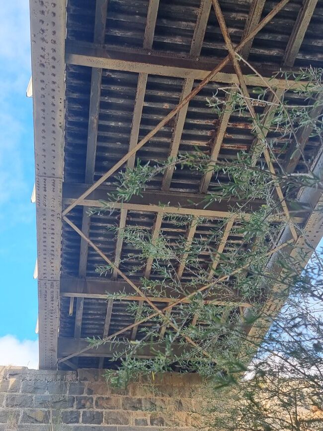
The under-deck of the old Pollocksford Rd bridge, just off the Hamilton Highway, near Geelong. The riveted iron / timber structure, and the stone pillar, show the advanced age of the structure. But given that it is more than one hundred years old, and was built almost entirely of secondhand materials at the time, it’s pretty good!
The interesting thing is that when the bridge was rebuilt in the early 1920s it was built almost entirely from secondhand materials. Because of a dispute within the then Country Roads Board, who refused to take responsibility for it, the bridge was built by the then Barrabool and Bannockburn shires, at the not inconsiderable expense of 3000 pounds. No doubt this factor influenced the decision to use secondhand materials! The Bannockburn engineer Mr ETM Garlick was the supervisor of the construction.
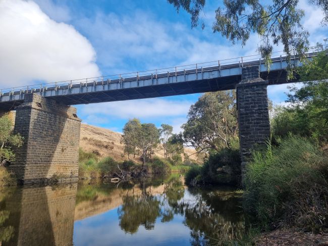
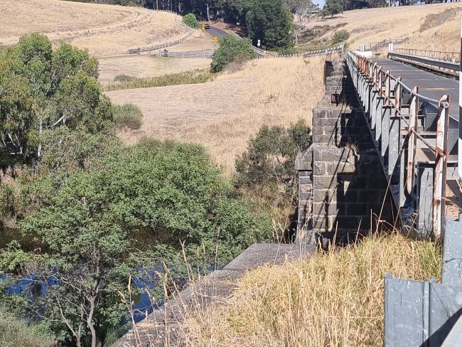
The stone and iron Pollocksford Road bridge was built in the 1920s to replace a bridge built in the 1850s. The original timber bridge was failing and desperately needed to be replaced, but the bluestone foundations were strong and sturdy, so they retained these.
Copyright © Koole Imaging.
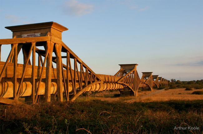
This very interesting aqueduct was built from 1913-1915 over the Barwon river, just south of Geelong. It was built to take sewage from Geelong to the treatment plant at Black Rock, near Breamlea. It was built by the Tasmanian engineers Edward G Stone and Ernest J Siddeley. The style was modelled after the steel Firth of the Forth bridge in Scotland, but was built of reinforced concrete.
Using the ‘Considere’ system of concrete reinforcement, cantilever trusses were built on fourteen concrete piers, with concrete girders between them, for a total length of 756 metres. The ovoid shaped sewer pipe was suspended underneath the girders. Cracks in the concrete appeared pretty quickly, and repairs were made in 1923.
The aqueduct was decommissioned in 1992, though it still remains there. It is in a state of disrepair, and there is no public access. There are plans to make the area at the south end of the aqueduct into a parkland area.
This page Copyright © ThisisAustralia.au
Hema HX-2+ Navigator – This is Australia! Brilliant both on road and off road!