Cape Otway Lighthouse on the Shipwreck Coast
Matthew Flinders wrote about this section of coastline ‘I have seldom seen a more fearful section of coastline’, and there have been more than 80 shipwrecks in this section of coastline, with hundreds of lives lost. No wonder it is called the ‘Shipwreck Coast’! This is why the Cape Otway Lighthouse was built. It has been in continuous operation since 1848, and is the oldest surviving lighthouse on the Australian mainland. It is situated on the cliffs of Cape Otway at the entrance to Bass Strait in the Southern Ocean. The original light was decommissioned in 1994 and replaced with a solar powered low power light, mounted on the front of the original tower, which displays three white flashes every 18 seconds
For many immigrants it was their first sight of land after leaving Europe many months before. Sadly, some never set foot on the land they saw. There are eight shipwrecks around Cape Otway, in which hundreds of lives were lost.
 Joe Mortelliti‘s life long love, from when he was first given a Brownie camera as a boy, was photography. It was the focus of his work life for many years. He loved to travel with his wife Marion to as many parts of Australia as he could. He had the ability to ‘see’ the beauty of our land in such a way that he could photograph it for the delight of others. These photos are a legacy that he has left us. Used by permission and with appreciation.

Copyright © Joe Mortelliti Photography
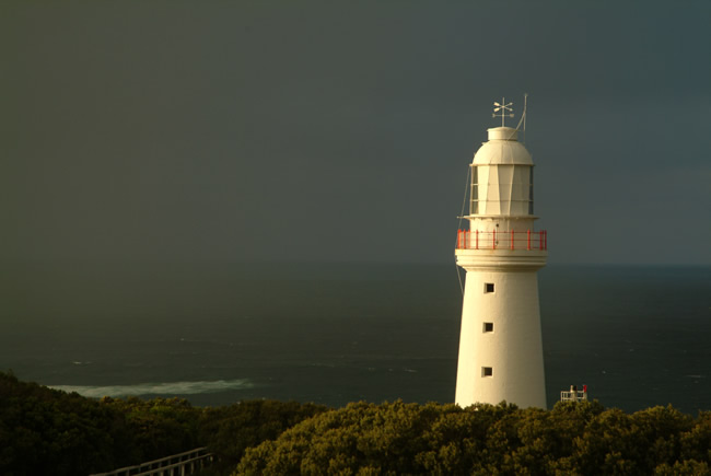
Cape Otway Lighthouse glows in the morning sunrise as rain approaches across Bass Straight. The dark heavy rain squall created a contrasting backdrop to the warm early morning sunrise on the stonework. These conditions changed rapidly and we only had a minute to capture it, and then it was gone.
Copyright © Joe Mortelliti Photography
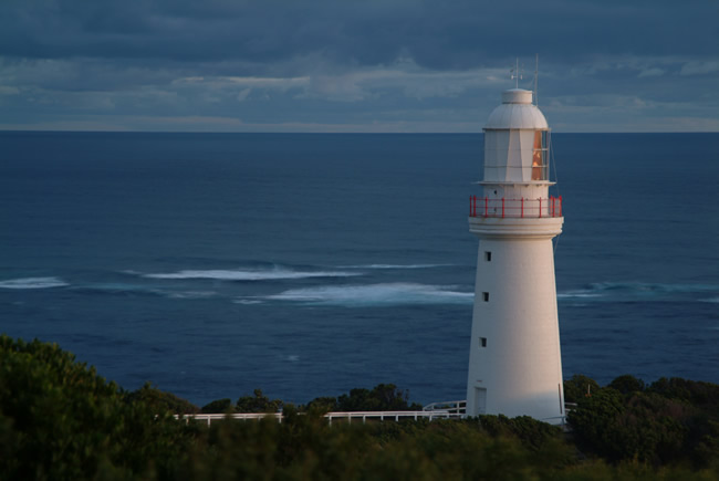
The sun has gone down at the Cape Otway light station. The light on the side of the light house is the reflection off the clouds as the sun is well down past the horizon. This light creates a soft glow on the stone-work.
Victoria State Map – This is Australia! A great and useful travellers’ map of Victoria
Copyright © Joe Mortelliti Photography
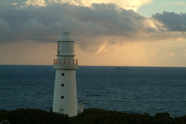
A container ship looks small passing through Bass Straight at Cape Otway. The original whale oil fuelled light shone 40 kilometres out to sea.
Copyright © Joe Mortelliti Photography
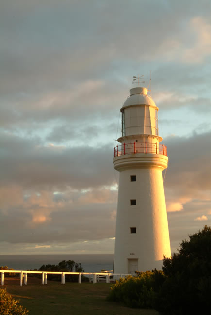
Cape Otway Lighthouse is the oldest surviving lighthouse on the Australian mainland. We stayed 3 nights in the Assistant Lighthouse Keeper’s quarters, and experienced the many changing moods of light and weather on this spectacular cape.
Hema HX-2+ Navigator – This is Australia! Brilliant both on road and off road!
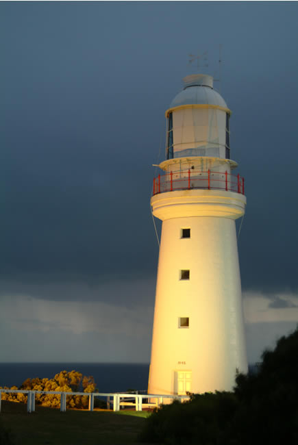
Copyright © Joe Mortelliti Photography
Rain falls behind the lighthouse on Bass Strait at twilight. Shooting in the twilight, with the rain squalls, spot lights on and stone-work glistening in the light. A magical combination.
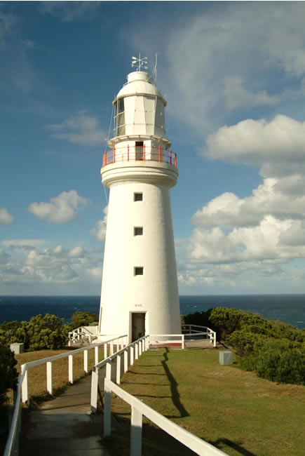
Copyright © Joe Mortelliti Photography
Originally known as Cape Albany Otway. Named by Lieutenant James Grant while in command of the Lady Nelson, in honour of William Albany Otway Esq. Captain of the Royal Navy and one of the commissioners of the Transport Board. The Otway Ranges have the same name origin.
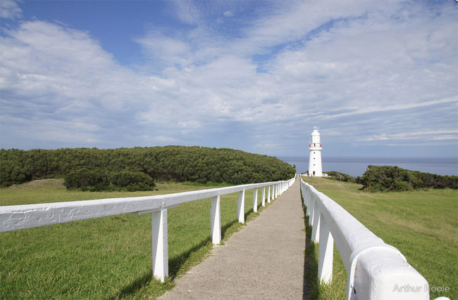
Copyright © Koole Imaging
Along the Great Ocean Road Victoria there is the Cape Otway Lightstation which is worth a look as one travels along this magnificent road. Cape Otway Lightstation is the oldest surviving lighthouse in mainland Australia. The light, which has been in continuous operation since 1848, is perched on towering sea cliffs where Bass Strait and the Southern Ocean collide.
Hema HX-2+ Navigator – This is Australia! Brilliant both on road and off road!
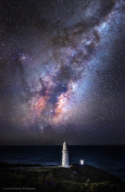
Copyright © Lachlan Manley Photography Used by permission and with appreciation.
This is a very interesting picture. By using some creative photography techniques, the photographer shows much more of the glory and beauty that is present in the sky than we can normally see. I love this fascinating pic!
The heavens declare the glory of God.
Lachlan Manley, the photographer, comments: The centre of our galaxy rising behind Cape Otway last weekend. The lighthouse is Australia’s oldest existing lighthouse, second ever built in oz and is well worth a visit.
Lachlan’s comments on the photography technique used are interesting: Lots of work goes into balancing exposure, colour etc in post to achieve a mix of what the eye can’t see and what the camera can’t see and our eyes do see. Our eyes have a much advanced dynamic range than our cameras and our cameras under long exposure can see a lot more than our eyes. i.e. colour aurora and milky way detail . This is shot at iso 10000, f4, 10 secs and iso 100, f4 at 30 secs for other frames for frames with navigational lights etc.. Its up to 18 frames merged.
Hema HX-2+ Navigator – This is Australia! Brilliant both on road and off road!
Copyright © Willem Schultink
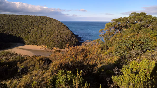
The afternoon sun gives a warm glow to this scene of the mouth of the Parker River. The remains of the sailing ship Eric the Red are on the beach next to the bend in the river.
If you would love to visit places like this, but have mobility issues, you might like to visit the Overlander Mobility website.
Copyright © Willem Schultink
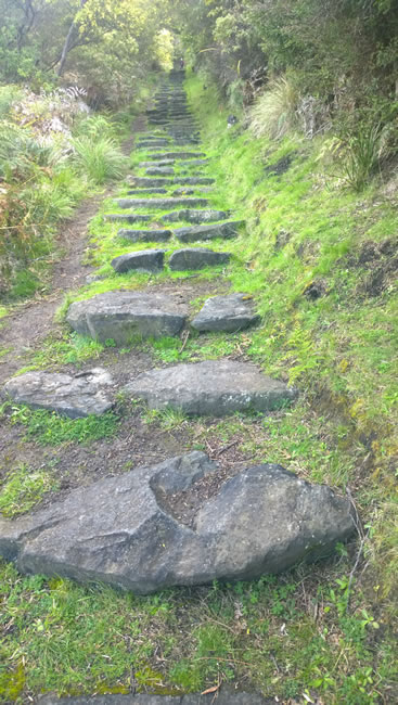
I have once been down these steps at Parker Hill Walk Track, near Victoria’s iconic Great Ocean Road. The steps lead to Parker Beach at the mouth of the Parker River. A delightful spot. We explored the wide open beach, with the remains of the sailing ship Eric the Red clearly visible – see pic below. But by the time I reached the top of the steps again I said to my hosts ‘Thanks for taking me there. I reckon that’s the last time I’ll be able to do those steps’.
But…it wasn’t the last time! In 2017 I went down – and back up – the steps, and explored Parker Beach, the wreck of the Eric the Red’, a creek and a waterfall. But then I used an off road mobility scooter, from Overlander Mobility. A true four-wheel drive mobility scooter / wheelchair which is capable of going up and down those stone steps!
Hema HX-2+ Navigator – This is Australia! Brilliant both on road and off road!
Copyright © Willem Schultink
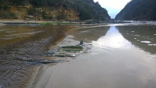
Parker Beach is a delightful place to explore. You can see the remains of the ship Eric the Red clearly in the foreground.
Eric the Red was a wooden ship of about 1580 tons displacement, from New York, with a cargo for the Melbourne Exhibition of October 1880. She was wrecked on the Otway Reef and broke up in 15 minutes. The remains of the wreck were later driven into the the mouth of the Parker River in a storm, where they remain to this day.
If you would love to visit places like this, but have mobility issues, you might like to visit the Overlander Mobility website.
Copyright © Willem Schultink
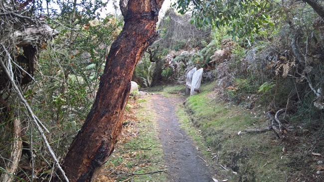
The section of the Great Ocean Walk from Blanket Bay to the Parker Inlet. The Parker Hill Walk Track – see previous pic – is also part of the Great Ocean Walk.
The Great Ocean Walk is the premier long distance walk in Victoria. It runs alongside the iconic Great Ocean Road for about 100 kilometres, from Apollo Bay to the Twelve Apostles. It can be completed as a 7 or 8 day walk, or any part can be done separately. There is quite a variety of different country if goes through, from beach to forest to open grassland/ farmland, sand dunes, cliffs – complete with fossils! – crashing surf and safe swimming beaches. Koalas, kangaroos, peregrine falcons … just some of the wildlife you’ll see.
Hema HX-2+ Navigator – This is Australia! Brilliant both on road and off road!
If you would love to visit places like this, but have mobility issues, you might like to visit the Overlander Mobility website.
Copyright © Willem Schultink
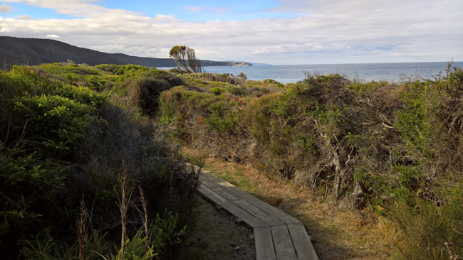
The section of the Great Ocean Walk from Blanket Bay to the Parker Inlet. The first couple of hundred metres of the Blanket Bay to Parker Inlet section is a boardwalk, which makes for easier, less muddy walking. This pic is looking back towards Blanket Bay. Blanket Bay is one of the few areas on Cape Otway that has good mobile phone reception.
The Great Ocean Walk is the premier long distance walk in Victoria. It runs alongside the iconic Great Ocean Road for about 100 kilometres, from Apollo Bay to the Twelve Apostles. It can be completed as a 7 or 8 day walk, or any part can be done separately. There is quite a variety of different country if goes through, from beach to forest to open grassland/ farmland, sand dunes, cliffs – complete with fossils! – crashing surf and safe swimming beaches. Koalas, kangaroos, peregrine falcons … just some of the wildlife you’ll see.
There is a limitation to the Great Ocean Walk. Some parts are too narrow for an off road mobility scooter to use. That severely limits access for some people.
If you would love to visit places like this, but have mobility issues, you might like to visit the Overlander Mobility website.
This page Copyright © ThisisAustralia.au


All the labels you use every day, with excellent service! EveryLabels.com.au
Hema HX-2+ Navigator – This is Australia! Brilliant both on road and off road!

