Blue Rag Range, Victorian Alps, Australia
The Blue Rag Range. Top of The Victorian high country. Only accessible in a good four wheel drive competently driven. Isolated because it is hard to get to. But worth the effort! Spectacular views! Nerve wracking driving!
Some of these pics may show scenes that have significantly changed since they were taken.
For a discussion on the causes of bushfires and how we can limit their dangers, read Bushfire!.
More info on bushfires in Victoria at State Library of Victoria.
 Joe Mortelliti‘s life long love, from when he was first given a Brownie camera as a boy, was photography. It was the focus of his work life for many years. He loved to travel with his wife Marion to as many parts of Australia as he could. He had the ability to ‘see’ the beauty of our land in such a way that he could photograph it for the delight of others. These photos are a legacy that he has left us. Used by permission and with appreciation.
Copyright © Joe Mortelliti Photography
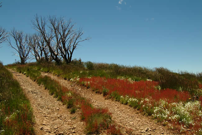
Rich red grasses and a bright blue sky backdrop made for a stunning image.
Victoria State Map – This is Australia! A great and useful travellers’ map of Victoria
Copyright © Joe Mortelliti Photography
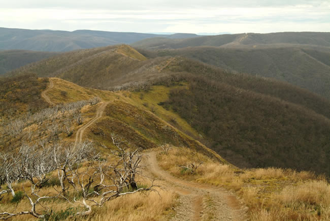
Spectacular Views along Blue Rag Track. The damage caused by the 2003 fires is reported will take 100 years to recover.
Press reports from High Country people point out that if you fly over the Bogong High Plains, a little further north from the Blue Rag Range, you will see everywhere that the areas that have been grazed are not burnt, and areas where there are no cattle, these areas are totally burnt. Parks Victoria refute such claims.
Hmm. That’d be an interesting drive to tackle. Not much margin for error, and the price of a mistake could be high! It’s a long way down if you get it wrong.
Copyright © Joe Mortelliti Photography
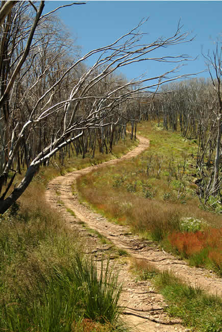
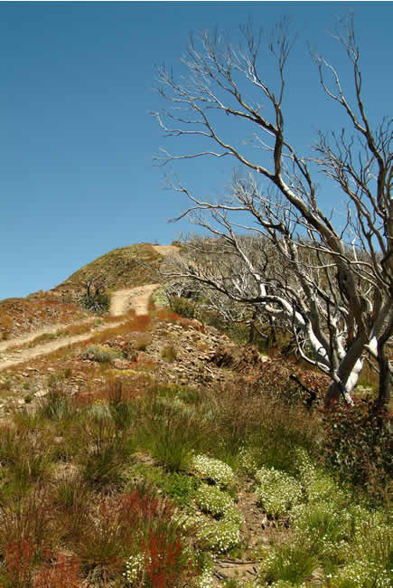
Blue Rag Track snakes its way over the tops of the range. This area makes you feel like you’re on top of the world.
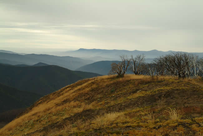
Interesting to compare it with the similar picture (above) that was taken eleven months earlier. A lot of regrowth is happening already. Perhaps the environment is not as fragile as some people believe, but has the ability to recover from natural disasters..
Copyright © Joe Mortelliti Photography
This rugged track is extremely steep in many places, and as you crest the top of a climb, you are looking at just the blue sky. The descent is then immediately on other side and you slowly edge over until you can see which way the track goes. With steep drops on both sides some people find this track too daunting.
Victoria State Map – This is Australia! A great and useful travellers’ map of Victoria
I understand the daunting bit. But I reckon it’d be a challenge! With a good vehicle and careful driving you should have no worries, and the rewards would be amazing!
January 2005. Copyright © Joe Mortelliti Photography
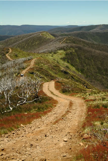
Blue Rag Track follows the ridge lines, with rough, rocky, steep climbs, descents and high precarious mountain edges. On both sides of the track are drops of thousands of feet to valley below. Some people find this track just too daunting.
January 2005. Copyright © Joe Mortelliti Photography
A classic “S” leads the eye over a section of Blue Rag Range.
Copyright © Joe Mortelliti Photography
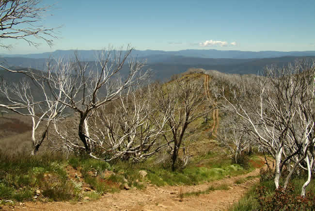
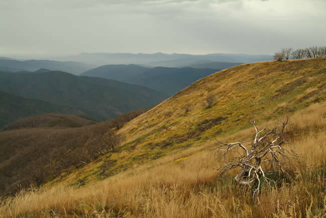
At the top of Blue Rage Range at 1500 metres high. The forest to left lies dead after the summer 2003 fires. A couple of valleys over lies the historic Wonnangatta Station and Wonnangatta valley, surrounded by mountains.
As we travelled through this area which is no longer grazed we could not help but notice the weeds that were taking over. People commented that they could not work out why this had to be so, why the politicians think they are doing the right thing. It would be only a matter of time before a fire started and all would be destroyed for years.
Copyright © Joe Mortelliti Photography
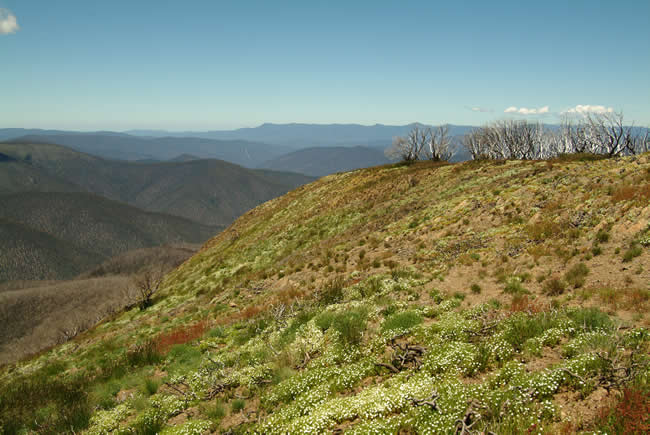
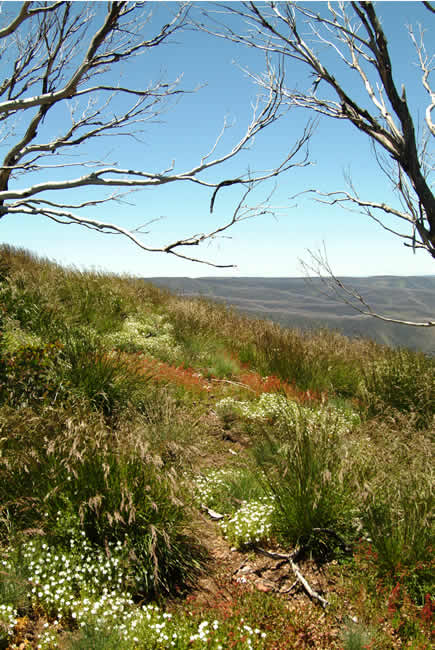
Rich greens and wild flowers on side of Mt Blue Rag with the burnt mountains to the background. It’s Interesting to compare the similar image taken in February 2004 of this year (above) and the dramatic colour changes.
Victoria State Map – This is Australia! A great and useful travellers’ map of Victoria
Copyright © Joe Mortelliti Photography
Contrast of the brown hilltop in the foreground with the blue haze of the mountains further away. A great pic!
Copyright © Joe Mortelliti Photography
The elements of wild flowers, coloured grasses, rugged trees and rocky ground across what feels like the top of the world, makes this one of the most spectacular high country sights.
Copyright © Joe Mortelliti Photography
Ground cover of grasses and wild flowers with stunning colours contrast against the ranges in distance that were blackened by the summer fires of 2003. Those fires burnt vast areas of the Great Dividing Range in both Victoria and NSW and was so intense that many of the burnt trees were killed by the intense heat and will not recover.
Many high-country people claim that closing off areas to cattle grazing and a track access contributed significantly to the fires’ destructive force.
This page Copyright © ThisisAustralia.au
All the labels you use every day, with excellent service! EveryLabels.com.au
Victoria State Map – This is Australia! A great and useful travellers’ map of Victoria