Victorian high country, Australia
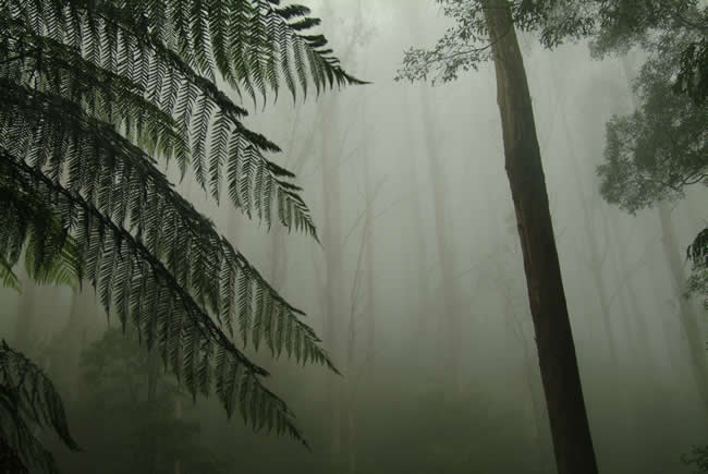
Entering the Victorian high country through Marysville along the Black Spur … the tall forests, the mists, the Mystic Mountains … These photos were all taken in 2003 and 2004, long before the disastrous fires on Black Saturday, the 7th of February 2009.
Some towns, like Marysville mentioned in various pics below, were virtually destroyed by the most savage bushfire with the highest death toll in Australian history. So some of these pics may show scenes that have significantly changed since they were taken. They therefore have historical significance.
For a discussion on the causes of bushfires and how we can limit their dangers, read Bushfire!.
More info on bushfires in Victoria at State Library of Victoria.
 Joe Mortelliti‘s life long love, from when he was first given a Brownie camera as a boy, was photography. It was the focus of his work life for many years. He loved to travel with his wife Marion to as many parts of Australia as he could. He had the ability to ‘see’ the beauty of our land in such a way that he could photograph it for the delight of others. These photos are a legacy that he has left us. Used by permission and with appreciation.

Copyright © Joe Mortelliti Photography
The evocatively named Black Spur is a very narrow windy road which unfortunately has many accidents, due to people driving too fast for the conditions. Fog during the day brings an eerie atmosphere to the Black Spur.
Copyright © Joe Mortelliti Photography
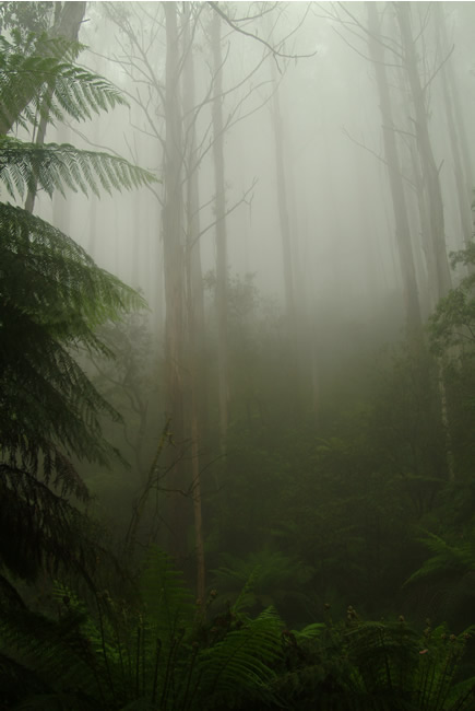
The green foliage diffuses into misty greens in the fog.
Victoria State Map – This is Australia! A great and useful travellers’ map of Victoria
December 2003. Copyright © Joe Mortelliti Photography
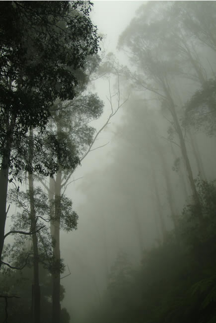
The road up the Black Spur is very narrow and only has a few limited stopping points, with nowhere to do U turns, so when this fog rolled in I kept shooting, quickly stopping at each vantage point.
Victoria State Map – This is Australia! A great and useful travellers’ map of Victoria
Copyright © Joe Mortelliti Photography
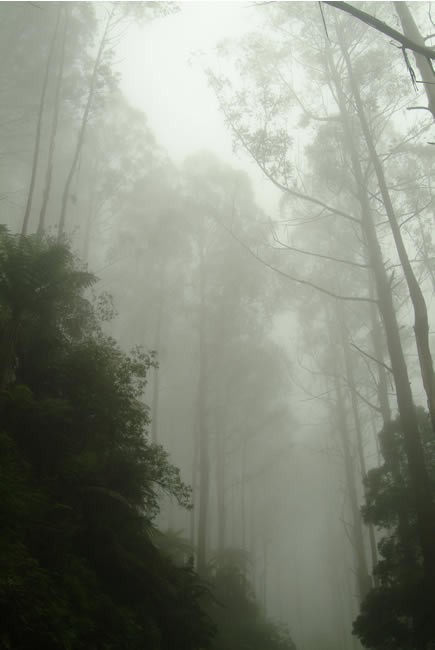
The Black Spur is noted as the gateway to the also evocatively named Mystic Mountains, with Marysville and Acheron beyond.
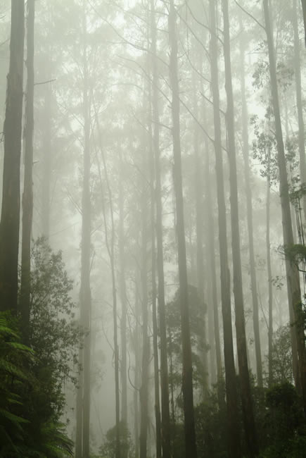
Copyright © Joe Mortelliti Photography
The Black Spurs tall timbers reach up through the mist.
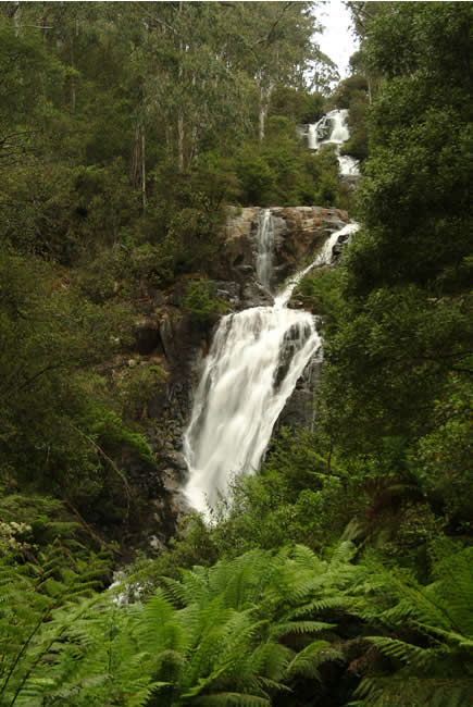
Copyright © Joe Mortelliti Photography
Near Marysville. A very easy walk from car park and feature flood lighting at night. These falls are 80 metres high and are Victoria highest waterfall.
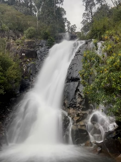
Victoria State Map – This is Australia! A great and useful travellers’ map of Victoria
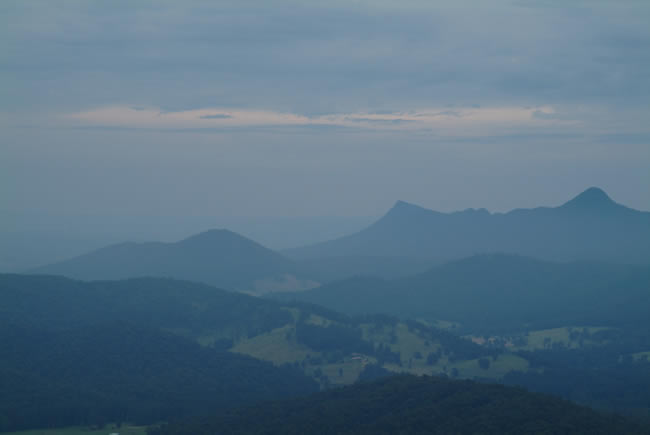
Copyright © Joe Mortelliti Photography
Travelling up a dirt track above Marysville brings you to a lookout that all will enjoy. We travelled late in evening and captured the ranges in the twilight light.
Copyright © A&N Schultink
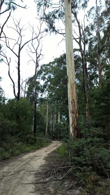
A moderately difficult track that in places could be quite challenging when wet. Pauls track in the Toolangi State forest near Dixons Creek. Here the track winds through tall timbers.
Copyright © Joe Mortelliti Photography
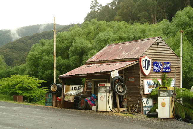
Woods Point is a very remote town deep in the Great Dividing Range, frequently visited by 4wd enthusiasts. Most of Woods Point was destroyed in the 1939 fires and then rebuilt.
The service station is a time capsule that still serves fuel, but only super petrol and diesel. Visiting the town is an experience. Locals from the region have pointed out that many people have mysteriously gone missing in the area over the years, never to be seen again, and that police records confirm some 35 people missing over the years. The area has many dangerous mine shafts.
Locals speculate that over many years corrupt city individuals involved in vice activities and gang disputes have sought refuge in the area due to it’s remoteness, but in due course these individuals have been caught up with and then … disappeared.
Copyright © Joe Mortelliti Photography
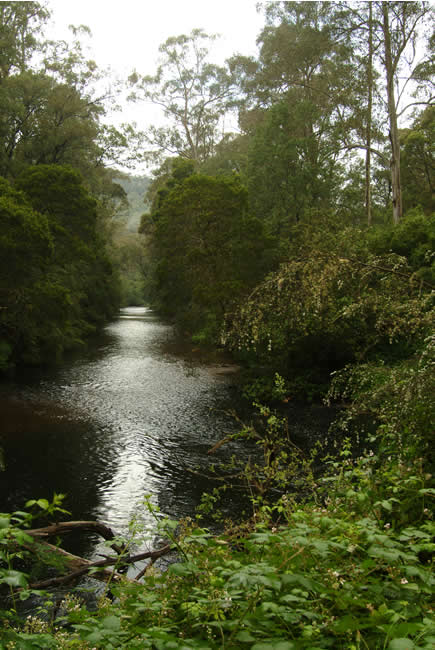
From Woods Point we travelled along the Jamieson River to the township of Jamieson. Jamieson was a gold mining town that provided supply links to the gold miners that worked in the region.
At Jamieson while traveling a dirt track on outskirts of town, we met Joe Blackridge who hand crafts ‘Lagerphones’, a musical instrument that uses beer tops to create a unique sound. He gave us a treat by playing and singing When the Saints Come Marching In. Joe, a builder by trade and gold miner, built the first house in Jamieson after the town was destroyed by the 1939 fires.
Copyright © Joe Mortelliti Photography
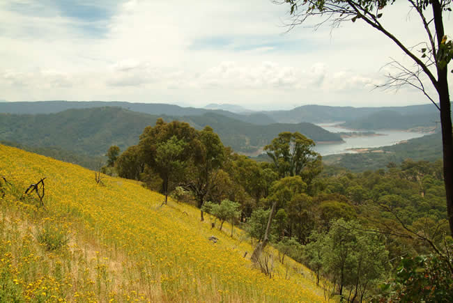
Looking down on area of Lake Eildon from Sky Line Road in the Eildon National Park.
Victoria State Map – This is Australia! A great and useful travellers’ map of Victoria
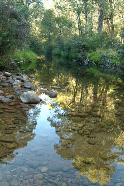
Copyright © Joe Mortelliti Photography
We camped at King River Hut and one of the best experiences is cooling off in the gentle stream of the King River at the end of a hot day of touring the Victorian High Country.
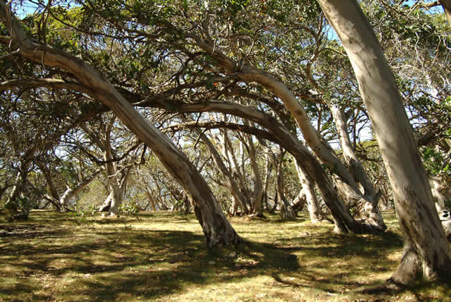
Copyright © Joe Mortelliti Photography
A steep rocky 4wd climb up Mountain Number 3 brought us to the top at around 1638 metres, to an area of large snow gums.
Even though it was a beautiful day with the sun filtering through, we were reminded of the harsh conditions that occur on these mountains as we looked at the wind swept gums.
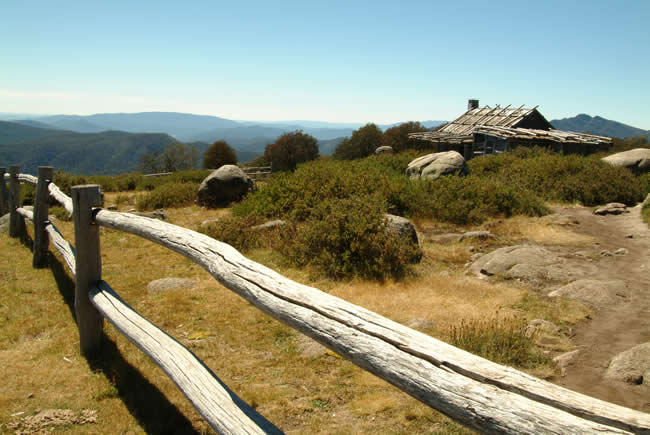
Copyright © Joe Mortelliti Photography
Craig’s hut on Mt Stirling was recreated for the movie The Man from Snowy River. Private land in the You Yangs near Geelong were also used as a location for the early scenes of this movie.
At 1747 metres the views of the high country from Craig’s Hut are spectacular. The hut has gone through three upgrades since. The original was only a movie prop but became so popular with visitors that a more robust construction was required.
Victoria State Map – This is Australia! A great and useful travellers’ map of Victoria
Craig’s Hut was again destroyed by bushfire in December 2006, and rebuilt in 2008, so the one you see in this pic no longer exists.
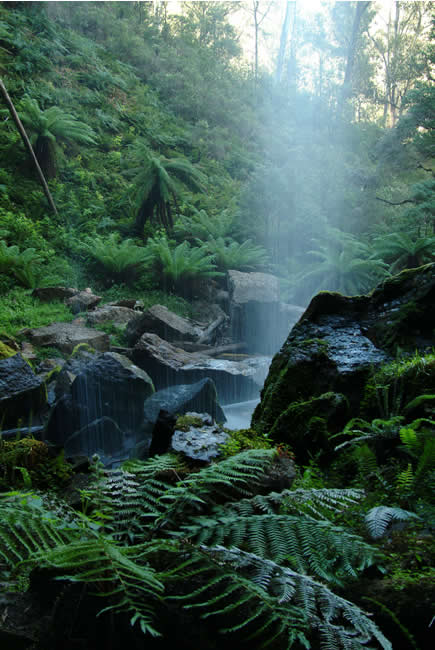
Copyright © Joe Mortelliti Photography
Bindaree Falls on Mt Stirling. It is a very easy walk to these falls and it is a treat to be able to stand behind the falls looking through to the lush ferns.
Victoria State Map – This is Australia! A great and useful travellers’ map of Victoria
Copyright © Joe Mortelliti Photography
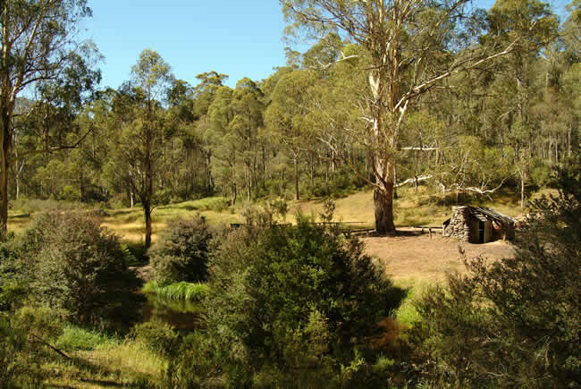
The present hut was built in 1937 using Broad Leaf Peppermint logs. This idyllic setting has the Howqua River flowing past only a few metres away. More than 100 mountain huts were razed by the 2003 summer fires.
For a discussion on the causes of bushfires and how we can limit their dangers, read Bushfire!.
You might like to consider the Australian Firefighters Calendar. From its humble beginnings, The Australian Firefighters Calendar was established in 1993 to support the Children’s Hospital Foundation, providing funds for research into childhood burns. Now in its 30th year, The Australian Firefighters Calendar has raised over $3.4 million for various charities.
Copyright © Joe Mortelliti Photography
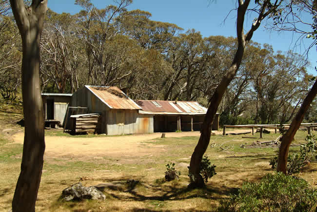
Built in 1955 with all the local cattlemen assisting in the project. The centre part is the original hut with a concrete floor. The two ends are extensions. The hut has 25 ‘beds’ and is regularly used by cattlemen today.
Update: The hut you see in the picture is no more. It was destroyed in the 2007 bushfires. It has since been rebuilt. I have had correspondence from Graeme who indicates that Bluff Hut is not on Mt Stirling, but is ‘…located between Mt Edley Stoney and Mt Lovick on the high ridge line that runs from The Bluff to King Billy between the Howqua and the Jamieson river valleys.’. As far as I have been able to check, this sounds about right. Thanks for the info, Graeme.
Copyright © Joe Mortelliti Photography
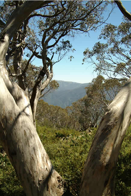
Mt Buller, 1804 metres high, is a backdrop to this shot of the high country landscape framed by the trunk of a rugged Snow Gum.
The resort offers 180 hectares of ski trails, and has won the Australian Ski Award for the ‘best all year round resort’ for 2 years running.
Victoria State Map – This is Australia! A great and useful travellers’ map of Victoria
Copyright © Joe Mortelliti Photography
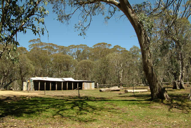
The Lovicks built many huts. This one of the more recent, constructed in 1960. It is located at Barclay’s Flat, near Mt Lovick. The first hut was built by Jack Lovick Snr in 1925 near the summit of Mt Buller and later burnt down.
Jack Lovick Jnr was declared a ‘State Living Treasure’ in 1980 after helping a number of search and rescue missions and also with the production of the Man from Snowy River movies.
Victoria State Map – This is Australia! A great and useful travellers’ map of Victoria
Copyright © Joe Mortelliti Photography
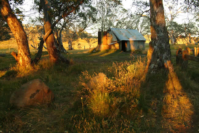
William Bryce who held the leasehold for the Wonnangatta Station built the hut in 1899. It is located near to where the body of Bamford was found after the Wonnangatta murders of 1918. The hut was completely rebuilt in the 1920s to 1930s. It is located at the edge of the Howitt High Plains.
Victoria State Map – This is Australia! A great and useful travellers’ map of Victoria
This page Copyright © ThisisAustralia.au


All the labels you use every day, with excellent service! EveryLabels.com.au

