Otway Ranges, south western Victoria
The quiet, the stillness. Water. Running water. In the creeks. Down little – and big! waterfalls. Rain! Weeaproinah in the Otways is the wettest place in Victoria.
 Joe Mortelliti‘s life long love, from when he was first given a Brownie camera as a boy, was photography. It was the focus of his work life for many years. He loved to travel with his wife Marion to as many parts of Australia as he could. He had the ability to ‘see’ the beauty of our land in such a way that he could photograph it for the delight of others. These photos are a legacy that he has left us. Used by permission and with appreciation.

Copyright © Joe Mortelliti Photography
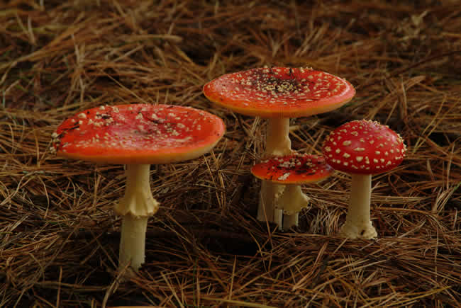
My wife Marion spotted these along the roadside from the car as we headed for Hopetoun Falls. We went back and forth looking for a grouping that looked attractive and we nearly gave up, but then decided to head down an adjoining track. A little way in brought us to this shot. Of all our shots, people seem always to get excited about the red fungi.
You have to look carefully to see the leprechauns! 🙂
The toadstool’s scientific name is Amanita muscaria, or ‘Fly Agaric’, a well-known introduced species usually found among deciduous and pine trees, but also now in eucalypt forests. They have white gills, white spore print, bright red cap with white flecks, white stem with a pronounced ring, and a broadened base of stem. They are poisonous and psychoactive, although some reckon you can eat them if you cook them carefully and the right way.
More info on this and other fungi at Bill Leithhead’s Web Site.
Copyright © Joe Mortelliti Photography
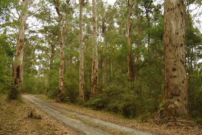
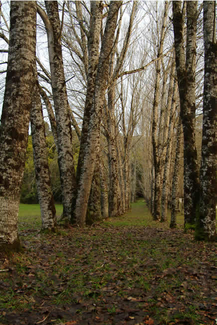
This track travels through a section of the Otway Ranges in Victoria. It is subject to seasonal closure and is in such good condition that you do not need a 4 WD to travel it. The rough appearance on the trunks of these group of trees deep in the forest caught my eye. While taking this picture in this isolated area I experienced … quiet and stillness, apart from the sounds of the forest.
Camping Guide to Victoria – This is Australia! – Camping all around Victoria!
Copyright © Joe Mortelliti Photography
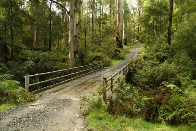
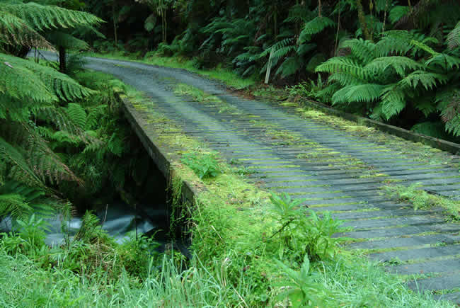
Deep in the Otways this wet moss covered bridge set amongst the tree ferns is a delight. Sunlight skims in from the left and picks up the edges and colours of the trunks on 3 grand trees at the side of the track.
Copyright © Joe Mortelliti Photography
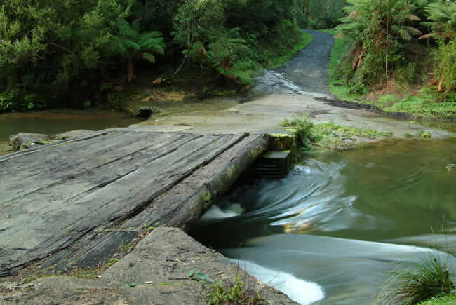
At top of the range you head down Wait a While Road, while looking at the ocean above the ranges as this is a very high vantage point. Further deep down in the valley is the Aire River and this wonderful log crossing. Recent rains had swollen the river and it was running swiftly. Nearby are bush camp areas amongst the tree ferns.
Copyright © Joe Mortelliti Photography
A beautiful moss-covered wooden bridge carries you over this delightful place.
Camping Guide to Victoria – This is Australia! – Camping all around Victoria!
Copyright © Joe Mortelliti Photography
Between Apollo Bay and Gellibrand, deep in forest.
The site was donated for public use and established as a bush camp by 4wd clubs and Parks Victoria. Located beside the Gellibrand River this is a very lush and wet area of the Otways.

Copyright © Joe Mortelliti Photography
Travelling on Noonday Track, down steep challenging sections to a small river crossing, we stopped for a break and admired the smooth texture and tones of the tree trunks.
Camping Guide to Victoria – This is Australia! – Camping all around Victoria!
Copyright © Joe Mortelliti Photography
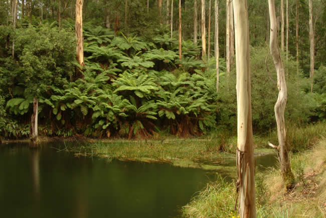
This peaceful spot is found on the walk track to Lake Elizabeth.
Lake Elizabeth is about a 1 kilometre walk from the car park. Some parts are steep, but the path is well made. This billabong is about halfway, and there is a well placed park bench to have a rest.
Copyright © Joe Mortelliti Photography
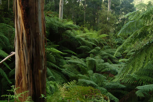
A valley thick with lush green ferns on the walk track to Lake Elizabeth. The texture and colour of the bark and tree trunk in the fore ground, provided a stunning contrast against the silky green ferns.
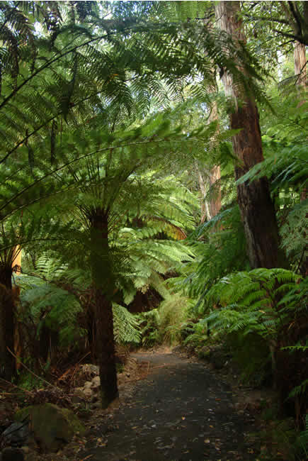
Copyright © Joe Mortelliti Photography
The walk to Lake Elizabeth is fairly long, but there is so much to see along the way that it’s worth the trek.
Copyright © Joe Mortelliti Photography
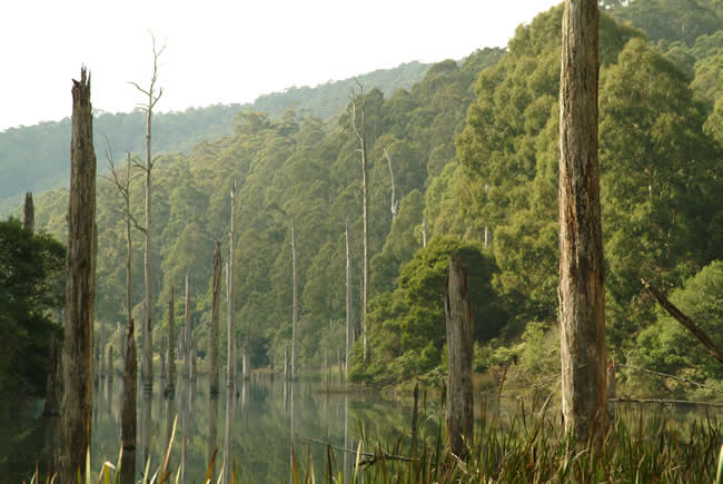
Near Forrest, the fern walk to Lake Elizabeth is one of the best to be seen. Arriving at the Lake, an eerie atmosphere of dead tree trunks reflecting in very still water, makes a striking scene.
In June 1952 a massive landslip dammed the course of the East Barwon River, causing the formation of what is now known as Lake Elizabeth. For some months the river was dry, to the perplexity of the locals, but in about August 1952 it started to flow again as the water had risen above the landslip. A couple of years later after some very heavy rains the top 20 metres or so of the landslip gave way and a wall of water complete with boulders and gravel went thundering downstream, threatening some local towns with flooding.
Lake Elizabeth today is a tranquil place with delightful walks and seating. It is about a 1 kilometre walk from the car park and camping grounds to the Lake, with a further 5 kilometres of walks around the Lake.
Copyright © Joe Mortelliti Photography
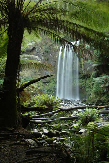
The walking tracks to most of the falls in the Otways are a delightful adventure. The fresh crisp air of the wet rainforest invigorates you. Hopetoun Falls access is quite steep as you make your way down into the Aire Valley.

Copyright © Joe Mortelliti Photography
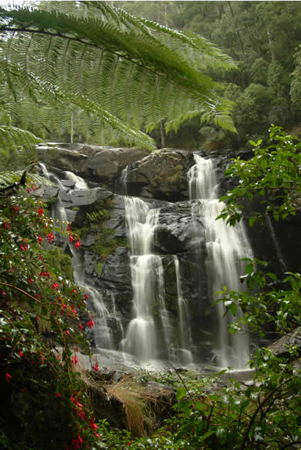
The walk track to Stevenson Falls along the Gellibrand River through lush green ferns. The sun filtered through for a few minutes making this beautiful scene even more appealing.
Camping Guide to Victoria – This is Australia! – Camping all around Victoria!
Copyright © Joe Mortelliti Photography
We were surprised to find fuchsias and berry bushes around the bottom of the falls. We enjoyed being here as the access to these falls is through the natural terrain, but you had to keep an eye on the leaches.
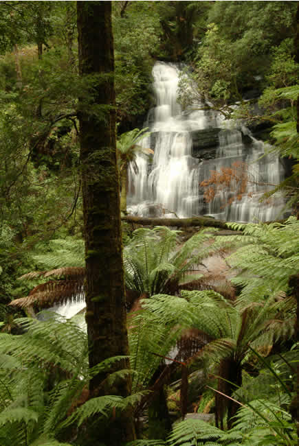
Copyright © Joe Mortelliti Photography
Magnificent falls and rain forest in the Otway State Forest.
Two weeks after this picture was taken trees at the falls were vandalized using chain saws, resulting in the area being closed to visitors for up to one year.
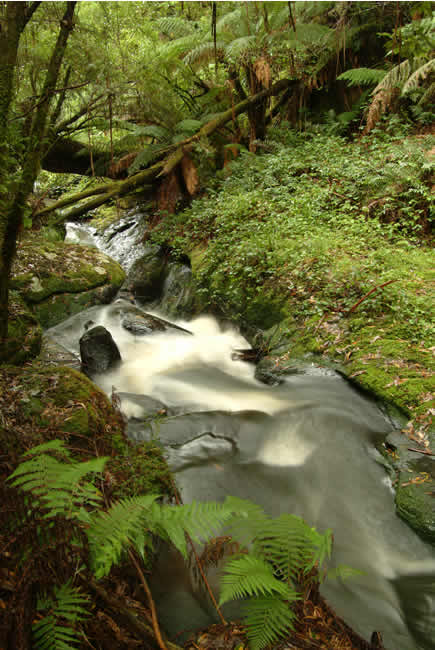
Copyright © Joe Mortelliti Photography
Water cuts a path through rock before cascading over the edge of Triplet Falls. This area was very dark due to the thick forest canopy. The shot required a very long exposure.
Camping Guide to Victoria – This is Australia! – Camping all around Victoria!
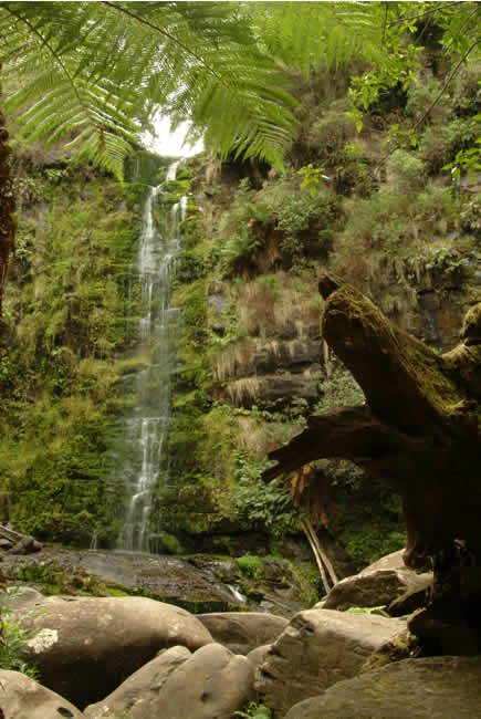
Copyright © Joe Mortelliti Photography
Located near Lorne. The flow at these Falls has considerably reduced due to the drought of the last several years.
I have visited Erskine Falls numerous times. It’s a steep walk down to the base of the Falls, with a lookout near the top as well. If I counted correctly, there are 315 stairs on the pathway down to the falls, and 315 on the way up, too! You’ll know you’ve been out for a walk by the time you get back. It is good that there are seats provided at several spots along the way because the climb is quite steep. I might suggest also that more seating on or near the viewing platform at the base of the Falls would be very useful.
The water level on Erskine Falls is much better this year – 2013 – than it was when the pic was taken ten years ago. The drought has broken! See pic below.
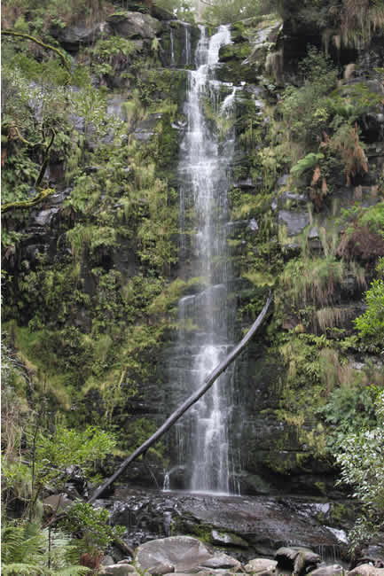
Copyright © Jessica Prins.
Erskine falls ten years later. Significantly more water flow, a fallen tree across the falls, and otherwise much the same. What you can’t see in the picture is the viewing platform that has been built since 2003.
Copyright © Joe Mortelliti Photography
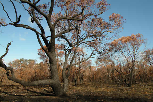
The damage done by recent fires to this area of the Otways near Anglesea took our eye. The contrast of black, blue and burnt orange totally transforming how the area normally looked.
For a discussion on the causes of bushfires and how we can limit their dangers, read Bushfire!.
More info on bushfires in Victoria at State Library of Victoria.
Copyright © Joe Mortelliti Photography
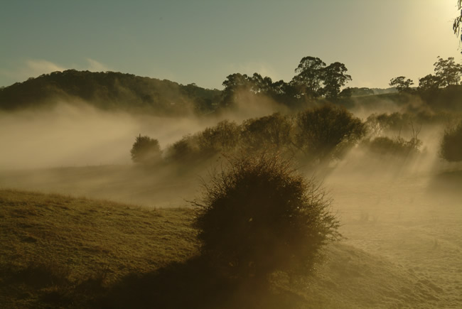
The stillness of morning fog at Forrest.
Camping Guide to Victoria – This is Australia! – Camping all around Victoria!
Copyright © Joe Mortelliti Photography
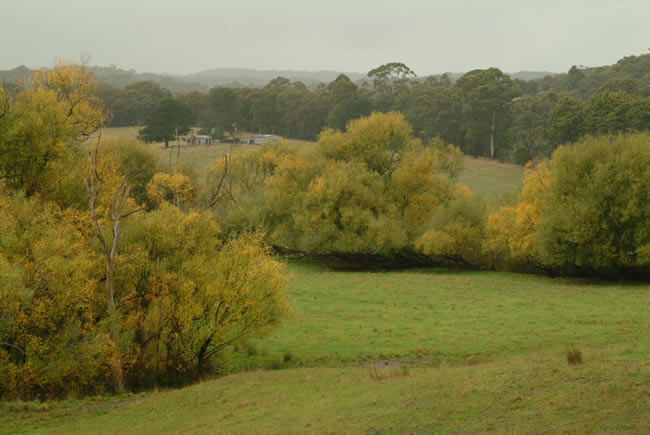
Autumn rains soften a rural landscape near Forrest.
Forrest is a small town in the Otways, with a population in 2006 of 170, that was established in 1891. The football team that was established that year is still going strong now, more than 120 years later. The railway didn’t do so well, closing in 1957 after also being established in 1891.
The West Barwon River runs through the town and the West Barwon Dam, which is a main water supply for Geelong, is a few kilometres south of Forrest on the road to Skene’s Creek and Apollo Bay.
Forrest is attracting attention as an alternative holiday place as house and land prices in the coastal towns such as Apollo Bay, Kennett River and Lorne climb ever higher.
More info on Forrest at Wikipedia
Copyright © Joe Mortelliti Photography
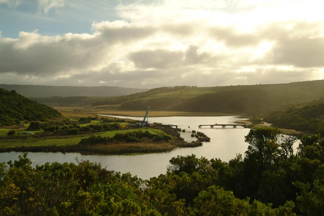
We camped by the river which is accessed via Hordern Vale in the Parks Victoria camp ground, known as Aire River East. This is another spectacular scenic area of the Otway region. The bridge is close to being rebuilt after being hit by lightning and catching fire. The bridge links Aire River East and Aire River West camp grounds.

Copyright © Joe Mortelliti Photography
At point where the river meets the sea, friends park their 4wd and take a walk in the sunset.
Camping Guide to Victoria – This is Australia! – Camping all around Victoria!
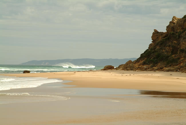
Copyright © Joe Mortelliti Photography
Marion and I sat watching these powerful waves constantly pounding the beach for some time. Simply a magic spot at the mouth of the river.
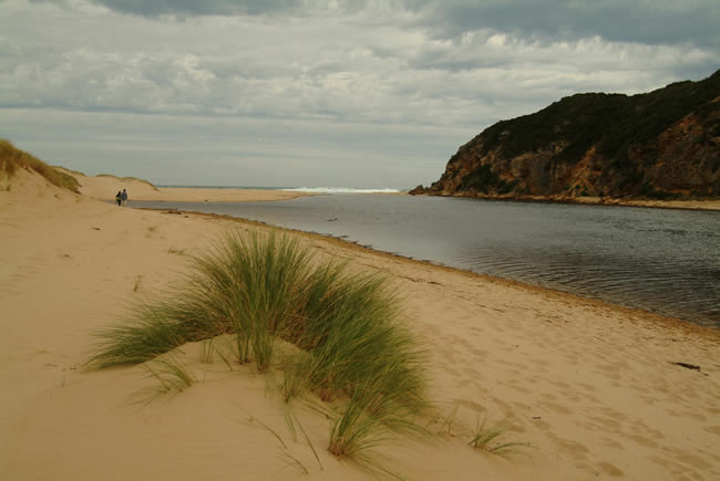
Copyright © Joe Mortelliti Photography
One of the great spots off the Great Ocean Road, a popular camping spot and good fishing on the Aire River.
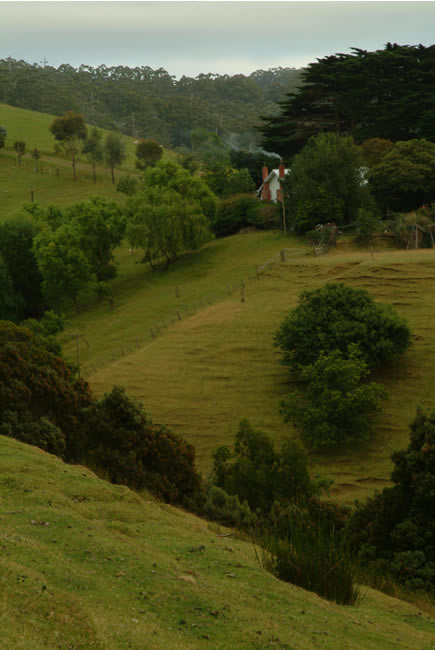
Copyright © Joe Mortelliti Photography
Dramatic hills between Apollo Bay and White Hawk.
This shot was taken standing on what was the original dirt Great Ocean Road that twisted through this area perched very high on these hills without guard rails. Locals recall a number of deaths from cars going over the edge along this section. The road was so narrow that when vehicles approached each other they would often both come to a stop and carefully “shuffle” past each other.
The road was re-aligned by the Country Roads Board in the early 1970s to provided ready access to the area of the Twelve Apostles and the Port Campbell National Park.
Camping Guide to Victoria – This is Australia! – Camping all around Victoria!
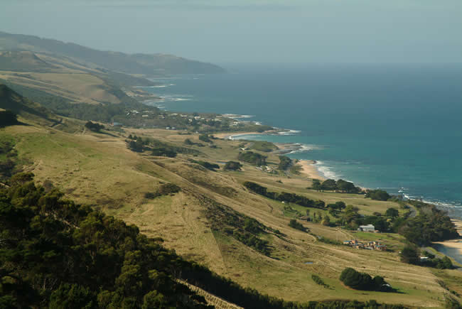
Copyright © Joe Mortelliti Photography
The walk to the lookout is worth the effort. Sweeping views of the coast line and Apollo Bay township itself are just beautiful. Access is via private property whose owners allow public access.
This page Copyright © ThisisAustralia.au


All the labels you use every day, with excellent service! EveryLabels.com.au
Camping Guide to Victoria – This is Australia! – Camping all around Victoria!

