Great Ocean Road, Victoria, Australia
The iconic Great Ocean Road. Regarded as one of the top 10 drives in the world. Hand built by returned soldiers after World War 1. Spectacular scenery all the way along. Back in 2002 and 2003 Joe Mortelliti captured some of the beauty with his camera.
 Joe Mortelliti‘s life long love, from when he was first given a Brownie camera as a boy, was photography. It was the focus of his work life for many years. He loved to travel with his wife Marion to as many parts of Australia as he could. He had the ability to ‘see’ the beauty of our land in such a way that he could photograph it for the delight of others. These photos are a legacy that he has left us. Used by permission and with appreciation.

Copyright © Koole Imaging
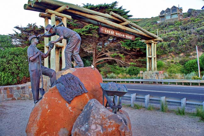
The Great Ocean Road is a permanent memorial to our servicemen and women from WW1.
Construction began in 1918 when thousands of returned servicemen came to the area. They built the road with only hand tools – picks, shovels, horse drawn carts, etc. The section from Eastern View, where this memorial is located, to Lorne was completed in 1922.
The road was eventually opened on 26 November 1932. There was a toll gate here at Eastern View where drivers had to pay two shillings and sixpence and passengers one shilling and sixpence – quite a bit in those days! The toll was abolished in 1936.
Copyright © Joe Mortelliti Photography
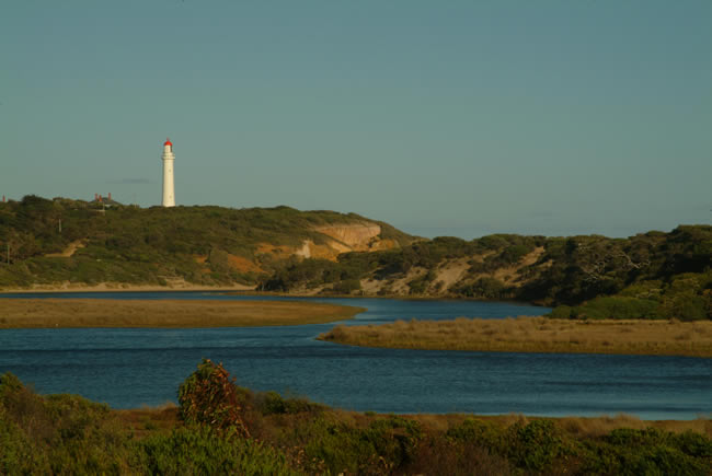
Split Point lighthouse, Airey’s Inlet.
Split Point was originally called Eagles Nest Point. The lighthouse was built in 1891. The original light source was vapourised kerosene. When it was taken over by the Commonwealth Government in 1919 the light was converted to acetylene and automated. Conversion to mains electricity took place in 1972. An early keeper had an interesting solution to the tedium of the light keeper’s job:
“The keeper at Split Point at Airey’s Inlet in Victoria did not exactly sleep on the job but he did not see why he should be deprived of his social life at night. He scratched a small hole in the black paint on the back of the lantern, which prevents the light shining inland and annoying residents. This keeper, Richard Joy Baker, scratched the hole to line up with the Airey’s Inlet Hotel. Each time the lenses rotated, the light winked through the hole, assuring the keeper (who had retired to the hotel) that all was well.”
More info on the Split Point Lighthouse at Lighthouses of Australia, Inc
Copyright © Joe Mortelliti Photography
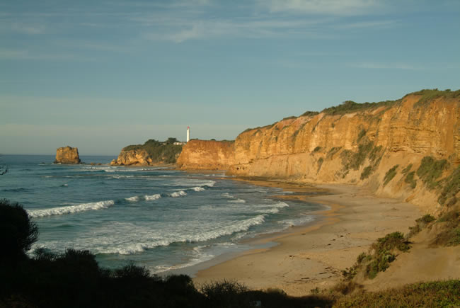
Split Point lighthouse, Airey’s Inlet, approaching from the east. You can see clearly where Split Point got it’s name.
Copyright © Joe Mortelliti Photography
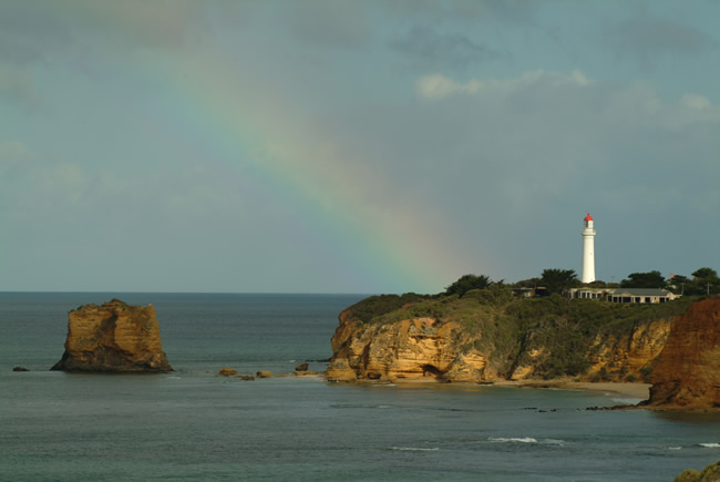
A narrow spotlight of sunshine breaks through rain clouds skimming across the lighthouse and a small portion of the cliffs, while the remaining cliffs remain subdued in overcast lighting. At the same time the sunlight creates a rainbow backdrop to the scene.
Copyright © Joe Mortelliti Photography
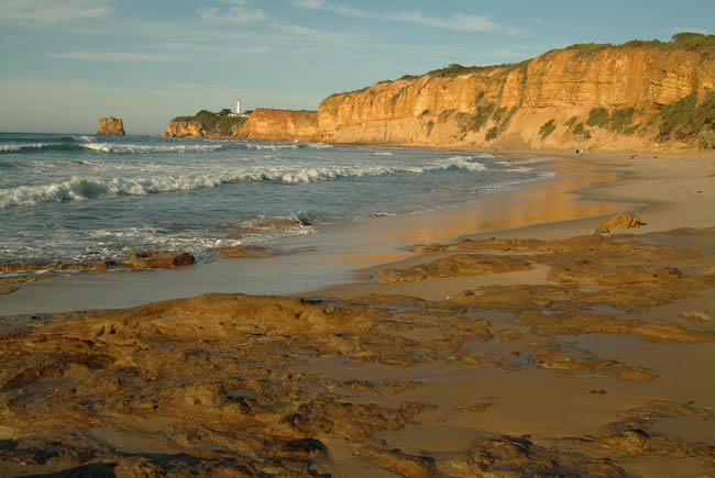
The beach here at Aireys Inlet is spectacular with the towering cliffs above the beach and the light house perched on top. The warm morning light illuminates the cliff face and the reflection in the wet sand looks like liquid gold.
Copyright © Koole Imaging
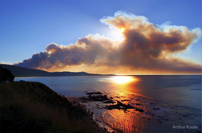
Near Aireys Inlet, nestled beside the Southern Ocean on Australia’s world famous Great Ocean Road.
The DSE (Department of Sustainability and Environment) was conducting fuel reduction burns but the wind picked up and for a while the fire had jumped containment lines, but was soon back under control. This image shows the rapid increase in smoke when the fire broke loose. Aireys Inlet peninsula can be seen in the distance.
For a discussion on the use of control burns to limit the dangers of bushfires, read Bushfire!.
Copyright © Joe Mortelliti Photography
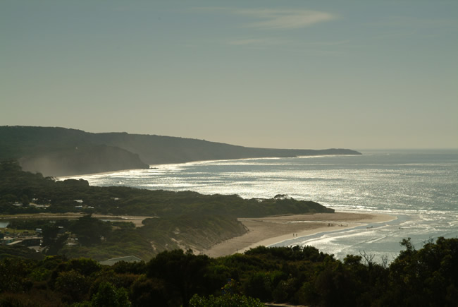
Anglesea beach glistens under the harsh Australian noon sun. Taking pictures at this time of day is not normally recommended, but in this case the sun shimmering on the water, with the sea mist against the cliffs made for a fine image.
Copyright © Joe Mortelliti Photography
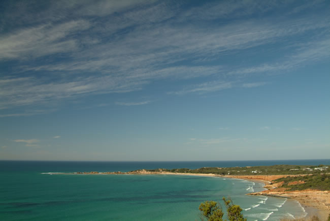
Just beyond Anglesea, a popular spot for surfing, fishing and swimming. The crisp land mass spearing out into the blue and green sea looked inviting on this sunny day. The wind swept clouds added interest to the blue sky.
According to the Beachsafe website, Point Roadknight beach is the safest beach in the Anglesea area, and is patrolled in the Christmas / New Year holiday period. The flip side of this is that waves for surfing are usually ‘…too small to bother about.’
Point Roadknight was named after William Roadknight, a squatter who landed sheep at Williamstown. It is an evocative name, giving pictures of large trucks with semi-trailers, lit up like Christmas trees, rumbling through the night. Just being named after a squatter takes away a bit of the romance. The website The Discovery and Exploration of Australia has some really useful info on the origins of names of places in Australia, although the arrangement of the website is a bit tedious.
Copyright © Joe Mortelliti Photography
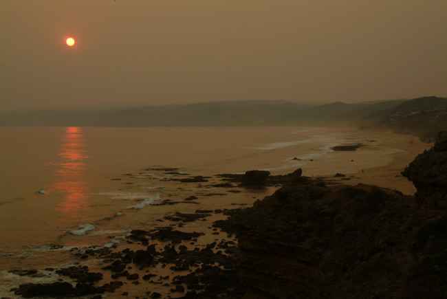
The sun sets at Fairhaven Beach through a haze of smoke and ash from summer bush fires in Victoria & NSW. We experienced an eerie atmosphere in the stillness.
Copyright © Joe Mortelliti Photography
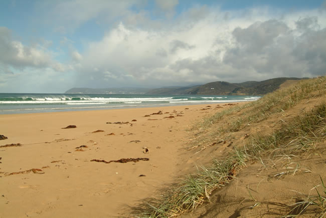
Looking across the beach at Moggs Creek toward Lorne. The crest of the waves are blown back by the wind making beautiful patterns. The beach is warm and sunny, rain falls lightly over Lorne while stormy clouds are coming in from the right.
Copyright © Joe Mortelliti Photography
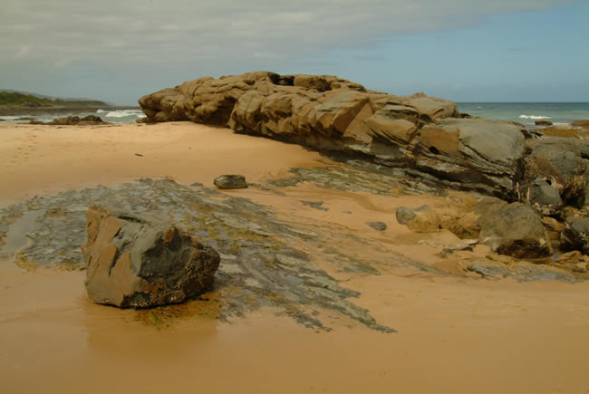
Rocks along the Great Ocean Road near Apollo Bay, sculptured by nature. The rocks create a wall on the waters edge, and a sandy beach meets the road edge. Cape Patton is visible in the background.
Copyright © Joe Mortelliti Photography
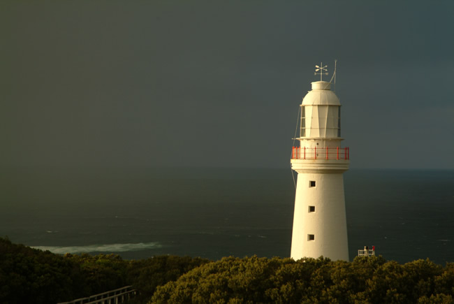
Cape Otway Lighthouse glows in the morning sunrise as rain approaches across Bass Straight. The dark heavy rain squall created a contrasting backdrop to the warm early morning sunrise on the stonework. These conditions changed rapidly and we only had a minute to capture it, and then it was gone.
Click here for more pictures of Cape Otway Lighthouse.
Copyright © Joe Mortelliti Photography
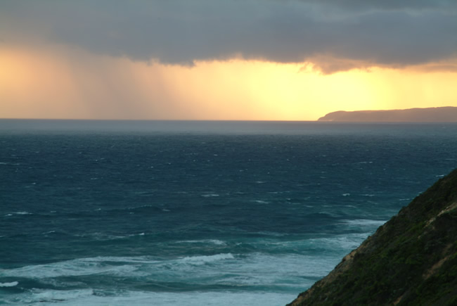
The view from the tip of Cape Otway toward Moonlight Head. A rain squall falls to the sea as the sun sets behind Moonlight Head.
Copyright © Joe Mortelliti Photography
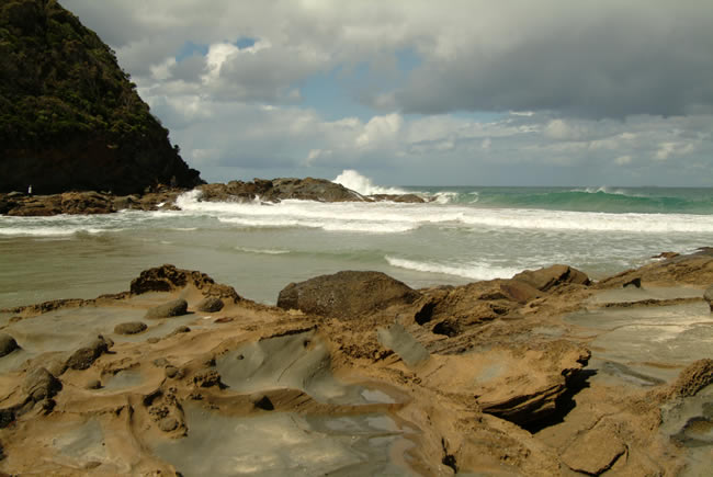
Parker Hill Beach is known for its notoriously large unexpected waves. The power of these waves made us feel vulnerable as we photographed from the rocks.
Materials to build Cape Otway Lighthouse arrived via this beach in the 1800s. Supplies for Cape Otway were provided by ship for many years, landing them on this notorious beach. A number of sailors lost their lives providing this service to lighthouse personnel.
Copyright © Joe Mortelliti Photography
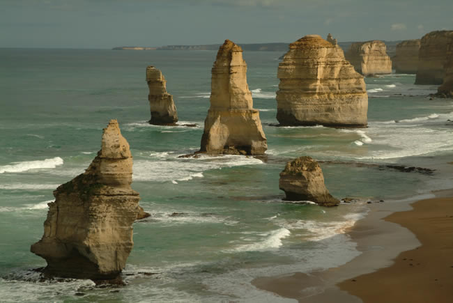
In 1969 I drove up the dirt to the cliff edge, got out took a few paces, and photographed the sunset on the Twelve Apostles. The transformation that has occurred at this viewing site is extensive with dramatic cliff hugging board walks. Access is by walking through a tunnel under the road from the car park. These facilities are impressive, designed for tourism, but I’m glad to have enjoyed it when it natural.
This is the scene from the main viewing point, captured in the beautiful morning light, which was low and crisp.
On 3 July 2005, the 50-metre-tall stack in the foreground of this picture collapsed, leaving eight.
Click here for more pictures of the Twelve Apostles.
Copyright © Joe Mortelliti Photography
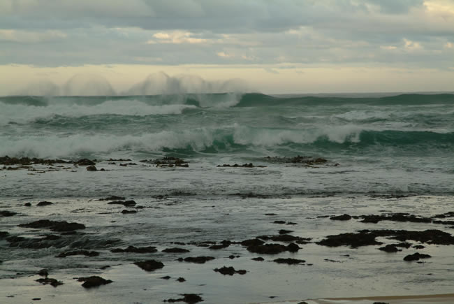
We went down the 200 stone steps to Gibson’s Beach just after sunrise.
We were the first people on the beach and the sand looked pristine as no footprints were to be seen. We were excited to be the first to walk on the unmarked sand for the day as we headed around the beach to view up close the two eastern structures of the Twelve Apostles.
The morning light was such that I chose not to photograph the structures, but instead we found ourselves enjoying the large waves and wispy patterns being created.
Copyright © Lynden Smith.
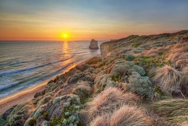
Walking back up Gibson’s Steps, I paused (to catch my breath!) and looked back at the scene that had occupied my attention for the past 2 hours and thought it worthy of one more capture. Instead of sand and water, I was now able to see some of the beautiful flora that covers the top of the cliffs while still soaking up the breathtaking sunset of late summer.
Copyright © Joe Mortelliti Photography
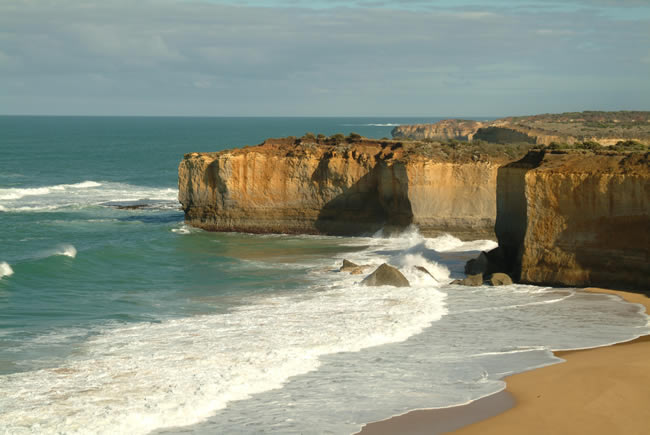
London Bridge is to the left out of the picture. The beach here is not accessible and wave action is normally very rough. We have found that this beach and Sherbrooke Beach put on the best ‘wild seas’ spectacle.
Copyright © Joe Mortelliti Photography
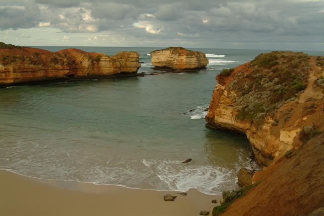
Bay of Martyrs, just on the outskirts of Peterborough. The cliffs here are far more red in colour than most of the cliffs along the Great Ocean Road.
Offshore lie four known wrecks, Halladale (1908), Young Australia (1877), Schomberg (1855) and Newfield (1892).
Copyright © Joe Mortelliti Photography
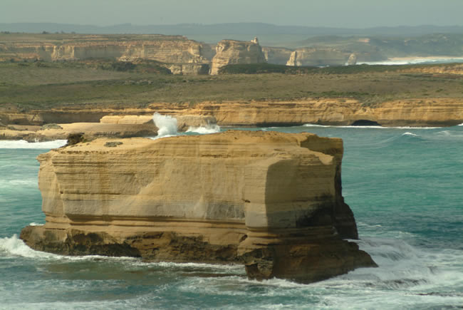
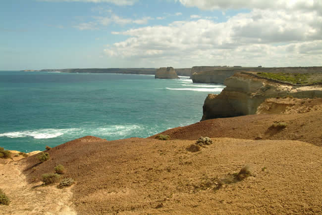
We headed down a dirt track to the edge of the cliffs to capture this scene. The track in is a bit rough and not the sealed access to be found at most viewing points. We spent a long time here without any other tourists arriving, but we could see them zipping along between Port Campbell and the Twelve Apostles. I used a long lens, and you can see huge waves crashing on rocks at Sherbrooke Beach. In the background are the Twelve Apostles.
Port Campbell was first settled in the 1870s, with the Port Campbell Post Office opening on 19 March 1874. It was renamed Port Campbell West Post Office in 1881 when a new Port Campbell Post Office opened near the wharf which was built in 1880. There has been quite a bit of growth in recent years, almost doubling from 372 in the 2001 census, to 599 in the 2006 census. The population rises during the holiday times. Port Campbell is on the Great Ocean Road, roughly halfway between Apollo Bay and Warrnambool.
Copyright © Joe Mortelliti Photography
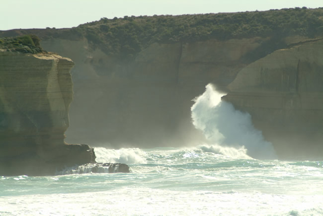
Looking toward Port Campbell, Sentinel Rock sits separated from the rugged coastline of the Port Campbell National Park. This view is accessed by a rough dirt track off the Great Ocean Road and not the normal sealed tourist access.
Copyright © Joe Mortelliti Photography
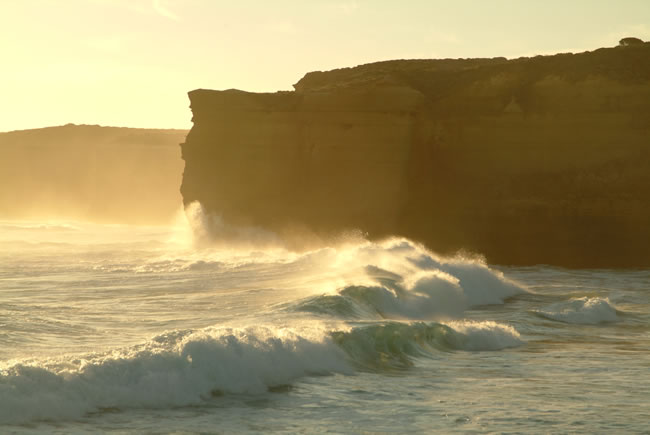
Waves hit the rocks at Sherbrooke Beach with enormous force. We so enjoyed this powerful spectacle that we stayed till after dark, capturing the sunset and making the long walk back to the car by torch light.
Copyright © Joe Mortelliti Photography
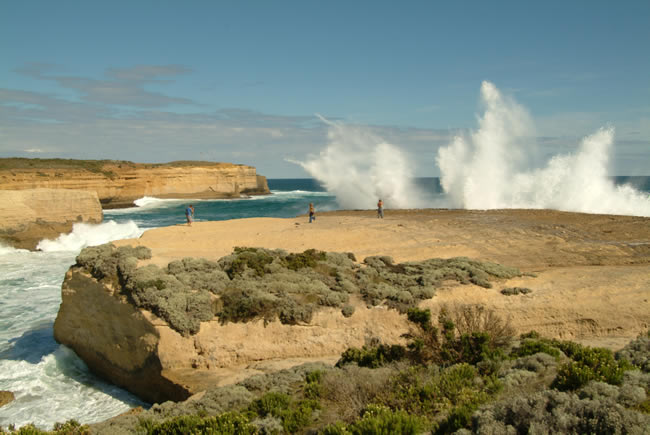
Sound and light show. A dramatic show of powerful waves and sound effects at Sherbrooke Beach.
Copyright © Joe Mortelliti Photography
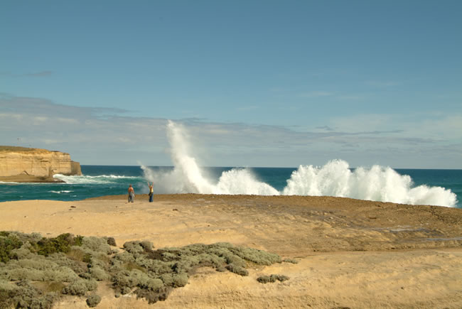
Young people enjoy being covered by spray from waves crashing into rocks flanking Sherbrooke Beach. In the distance is Broken Point and around the corner out of sight is the famous Loch Ard Gorge.
Copyright © Joe Mortelliti Photography
WOW! Young people amazed at the power of the waves crashing into rocks flanking Sherbrooke Beach.
Copyright © Joe Mortelliti Photography
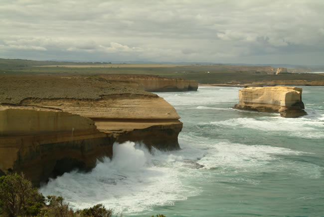
At end of a dirt track is this view back toward Sherbrooke beach. Watching the waves climb the cliff face is a powerful sight.
This page Copyright © ThisisAustralia.au


All the labels you use every day, with excellent service! EveryLabels.com.au

